Weekend Walk: Mirfield & Whitley Circular


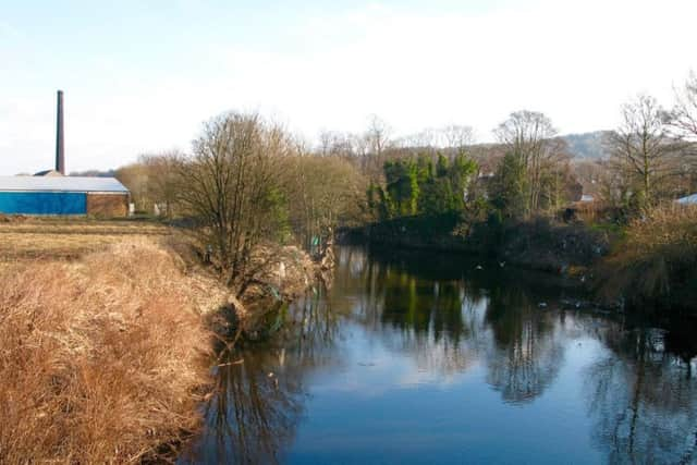
The paths are mostly well used and easy to follow. The terrain is a mixture of undulating farmland and quiet woodland, where two centuries ago small coal mines were sited to fuel steam-powered machines at Mirfield’s many textile and flour mills. The walk climaxes with stretches of path along the River Calder then, finally, the Calder and Hebble Navigation. Shepley Bridge was once a significant boat-building centre for Yorkshire canals and produced a type of barge known as West Country Keels. Watch out for jays and great-spotted woodpeckers around the woods, Canada geese on the River Calder.
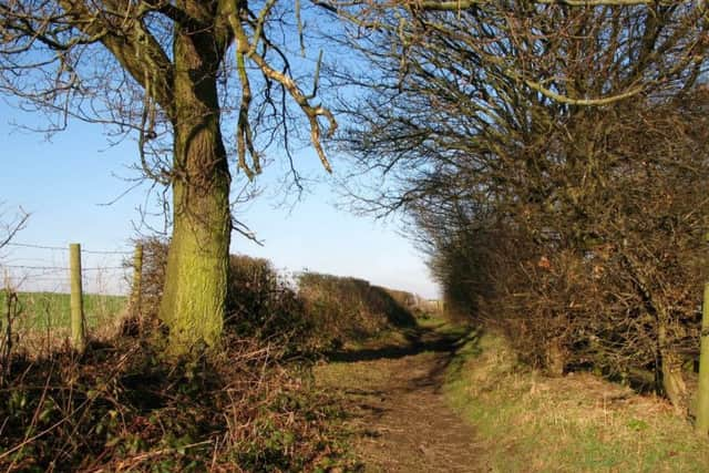
1. Walk south from Mirfield station, cross the bridge and turn left at a mini-roundabout. Cross with care and take a right turn to follow a path between houses. At a junction turn left and continue to a track. Turn right then quickly left. Go over a stile and follow the field edge up the side of Briery Bank woods. At a stile on the right, angle left to a footbridge and follow the obvious path uphill to a track.
Advertisement
Hide AdAdvertisement
Hide Ad2. Cross the track and climb steps ahead, continue to a stile and turn right on a good path. Downhill, go slightly left to keep with the path and follow it uphill to Brier Knowl Farm. Go left at the house and follow the road past buildings. Continue on this path uphill, and in woodland take a handgate on the left. Follow this path out of trees and along a field edge to turn right over a stile and emerge on Whitley Road.
3. Turn left to walk past the ice-cream parlour and Whitley Reservoir. At the Woolpack pub turn left on Scopsley Lane and walk past houses. At the end follow it right on a bridleway caled Back Lane. When the road ends continue between hedges with a golf course on the left. Follow the bridleway downhill past Jordon Wood to a junction marked with a boundary stone at the bottom.
4. Turn left, then right on a flagged track leading into woods. The path leads to a bridge over the railway line. Follow it left on the other side then fork right to walk beside the River Calder and pass through a pub car park to reach a main road. Turn right to cross Shepley Bridge then left with great care to use a smaller bridge and swing right onto the towpath of the Calder & Hebble Navigation. At the third bridge leave the canal. Turn left to the station or right to Mirfield town centre.
Difficulty rating: 2 stars.
Distance: 5 1/2 miles
Time: 2 1/2 hours.
Map: OS Explorer sheet 288 (1:25,000) Bradford & Huddersfield.
Parking: Mirfield.
Advertisement
Hide AdAdvertisement
Hide AdPublic transport: Mirfield is served by trains from Leeds, Wakefield and Huddersfield and is on bus routes including those from Bradford, Halifax & Huddersfield. For services check www.wymetro.com or 0113 245 7676.
Refreshments: Mirfield & Whitley Lower.
Toilets: Mirfield & refreshment customers.