Appeal for Calder Valley local knowledge to tackle floods


The agency is appealing for help to produce a map of field drains, mill ponds and other water infrastructure which could, in turn, be repaired and upgraded as part of plans to manage flood risk.
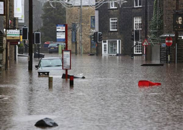
The Calder Valley has repeatedly been hit by flooding in recent years with communities in the area among the parts of Yorkshire among the worst hit by the Boxing Day storms.
Advertisement
Hide AdAdvertisement
Hide AdAndrew Coen, the Environment Agency’s lead engineer for the Calder catchment, said: “A number of local people and landowners have asked whether we can make use of the large network of historic but now redundant water infrastructure which was built in the 19th century to power local mills.
“Although we have a lot of information about the Victorian water infrastructure, there will undoubtedly be features which have not been mapped but which are still known by local people. Some of these could be significant in helping us to work out whether they could be upgraded and used again manage flood risk in the valley.”
“We are also keen to learn more about existing and historic land drainage systems so we can better understand the role they have now and the role they might have in the future to help reduce flooding.”
The agency is due to publish a comprehensive 25-year plan for managing flood risk in the Calder Valley in October as part of the Government’s response to the December floods.
An action plan specifically for Mytholmroyd has already been published.
Contributions to the map can be posted online at http://tinyurl.com/calderdaleheritageinfo.