Free guide breaks down epic trail through Dales valley


The free, online navigational aid can be printed off and followed to traverse the Nidderdale Way which encircles the River Nidd and starts and ends in Pateley Bridge, while taking in some of Yorkshire’s most recognisable landscapes along the way.
Devised by the Upper Nidderdale Landscape Partnership, a group funded by the Heritage Lottery Fund and the Yorkshire Dales LEADER programme, the guide breaks down the long-distance route into its traditional four stages, each of which are no longer than 15 miles and offer contrasting landscapes.
Advertisement
Hide AdAdvertisement
Hide AdIain Mann, scheme manager at the Upper Nidderdale Landscape Partnership, said: “It’s a simple, online guide that can be printed in easy to use sections.
“As well as highlighting famous landmarks along the route, we’ve included some hidden gems. The nature of the route makes it perfect for those seeking a long walking weekend so there’s an accommodation guide too.
“You don’t need to be a seasoned rambler, the walking terrain is moderate and there are country pubs and cafés in the Dales to refuel at, and even a Michelin starred restaurant on route.”
The Partnership has carried out conservation work at heritage sites along the route which walkers can now enjoy, such as Fishpond Wood which was landscaped by landowner John Yorke in the 18th century and features a restored icehouse.
Advertisement
Hide AdAdvertisement
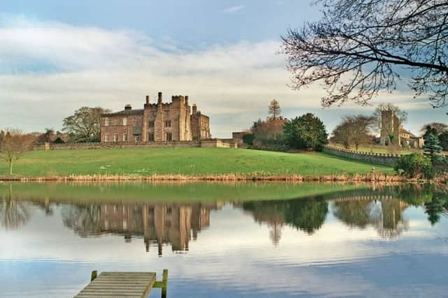
Hide AdObvious highlights along the trail include Ripley Castle and its 18th century gardens, How Stean Gorge with its dramatic ravine, and the gritstone sculptures of Brimham Rocks.
Stage one from Pateley Bridge to Middlesmoor, includes Scar House Dam, the largest dam in Britain when it was finished in 1936, and stage two, from Middlesmoor to Bewerley, takes in one of the most photographed churches in Britain, in Middlesmoor.
Stage three, from Bewerley to Ripley, includes the gritstone crag, Guisecliff, which rivals Brimham Rocks for views, and reminders of centuries past with the old Packhorse Bridge near Birstwith, while stage four winds from Ripley to Pateley Bridge.
To download the guide, visit www.uppernidderdale.org.uk