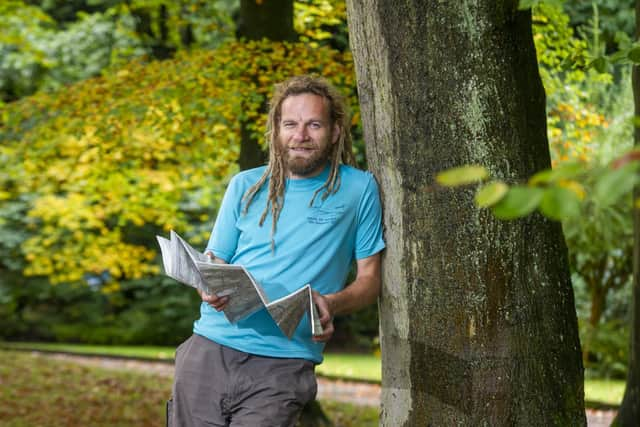
The Yorkshire cartographer making hand-drawn maps of the region's walking spots


And a Hebden Bridge cartographer’s work may be just the aide ramblers need to better explore the picturesque region.
Sheffield-born Chris Goddard grew up in Oughtibridge by the woods of the Upper Don Valley, and with the Bradfield moors on the edge of the Peak District just a short walk away – a suitable locale for his first forays into map making.
Advertisement
Hide AdAdvertisement
Hide AdEven on a family holiday to Corfu as a teenager, Mr Goddard would be wandering Kassiopi determined to make sense of the landscape rather than sitting by the pool. Mr Goddard, 42, said: “I was always fascinated with maps as a young kid. I just mapped everywhere I went in some way.”
He later studied geography at St Catharine’s College, Cambridge, and worked as a Rights of Way and National Trails surveyor for the Lake District National Park before settling in Hebden Bridge with his partner, Caroline, in 2006.
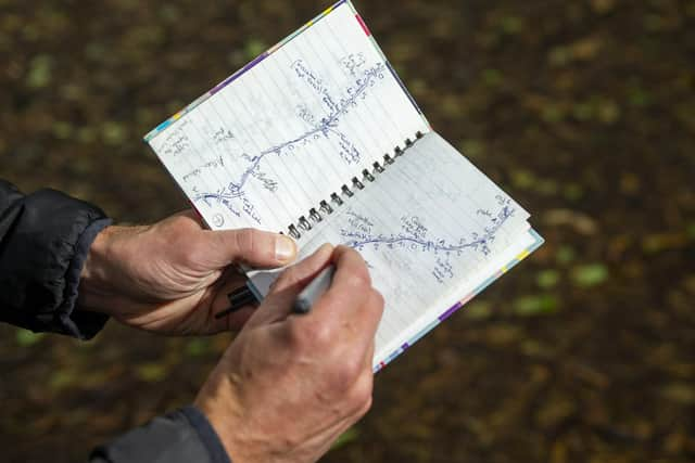
On his return, he took to yomping on the Upper Calder Valley but found that the Ordnance Survey maps lacked the detail he desired, so again began to make his maps.
In recent years Mr Goddard, 42, has been able to carve out a career as a cartographer, so far producing three main books of hand-drawn walking and exploration guides: The South Yorkshire Moors, The West Yorkshire Moors and The West Yorkshire Woods Part 1 - The Calder Valley.
Advertisement
Hide AdAdvertisement
Hide AdHe is now working on the second part of his West Yorkshire woods books, focusing on areas of Leeds, Bradford, and Castleford in the Aire Valley, which he hopes to release early next year through the Gritstone Publishing Co-operative
And he believes that walkers still enjoy having a physical guide to aide them.
He said: “People still like to have a proper thing in front of them. I don’t think proper maps will die.
“I use technology to help me make my maps in a way someone like (Alfred) Wainwright didn’t,” said Mr Goddard, “but when you’re in the countryside, you don’t just want to be staring at a screen.”
Advertisement
Hide AdAdvertisement
Hide AdThe books are also sources of local history. He added: “Of the people that buy the books, people don’t necessarily go out walking with them.”
Other maps that Mr Goddard has produced include an illustrated guide to the areas Anne Lister – the inspiration behind BBC television series Gentleman Jack – lived and frequented.
Mr Goddard, who can be found rambling with his dog, Alfie, is also working on a book based on the Yorkshire Coast – which he wants to release as the England Coast Path – but the projects are unlikely to end there.
He said: “Think of the tiny areas I’ve covered.
“There’s so much to go at just in Yorkshire.
“There’s more than I could do without leaving the county.”
For more information, visit Chris's website.