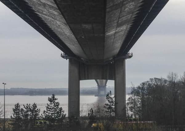
Bike Route: A different view from the bridge


Dad borrowed grandfather’s car and packed all of us, luggage, cricket bat and stumps in the old Austin. The week of glorious sunshine and beach cricket flashed by and the sad feeling of going home was tempered by a ferry journey across the Humber on The Lincoln Castle. Traffic now flows across the Humber Bridge at a greater speed than any ferry. This 21 mile-route sets off from near the bridge and ends with an unusual view of the triumph of civil engineering.
1. Use the Humber Bridge Visitor Centre car park and retrace your route to Ferriby Road. Continue along the A15, using the cycle path to negotiate the busy road, and turn left along Ferriby High Road. The bridge is behind you. The cycle path swaps from the left to the right. Continue into North Ferriby and turn right into Woodgates Lane after the Duke of Cumberland pub. The road rises as you make your way to a T-junction on the edge of Swanland with a squat 1930s water tower on the left. Turn left, on Mill Road, and enjoy the descent to another junction direction Melton and Welton.
Advertisement
Hide AdAdvertisement
Hide Ad2. Ride towards Melton over a roundabout and into Welton. Turn right on East Dale Road and ride to the village centre. Go past the church and turn right and right again around the one-way system to be in Cowgate. Ride past the pond and the rear of St Helen’s Church and turn left on Kidd Lane. The road rises and just after Hall Walk turn right, heading north, direction Beverley. Continue straight on as the road rises as it passes through a wood, go over the crossroads at Riplingham, to the next crossroads, just after two bright blue barn doors, and turn right, direction Walkington and Beverley. In a few minutes turn right at the next crossroads to Little Weighton.
3. Into Little Weighton and turn right on Rowley Road. There’s a cafe at Croft Park. Follow the road as it passes Rowley Manor and arrive at a T-junction and turn left. Ride past a village sign for Rowley to a junction, direction Swanland, and turn right. Turn left in half a mile, signed Occupation Lane. Skirt the edge of Swanland and turn left, picking up blue signs for the cycle route back to the Humber Bridge.
4. Over a roundabout on the B1231 and turn right on Jenny Brough Lane. The road swings to the left and right as it passes Hessle Mount School on the left and a ubiquitous white telephone box to a major crossroads with Boothferry Road. Observe the traffic lights and cross over. Ride over another crossroads as you head back to the river. Turn right on Cliff Top Lane by a white wall following a blue sign for cycles to the bridge.
5. The road turns into a track as you ride through a barrier and under the bridge. The fading winter light decreased as we rode under the steel and concrete bridge. The view across the Humber is a different one as the 4,626 feet span stretches out in front of you. Leave the bridge behind you and ride back towards the car following the cycle paths.
Difficulty Rating: HHHHH
Some climbing
Distance: Approximately 21 miles
Time: Two and a half hours
Cafe: Little Weighton
Public toilets: At start and finish.