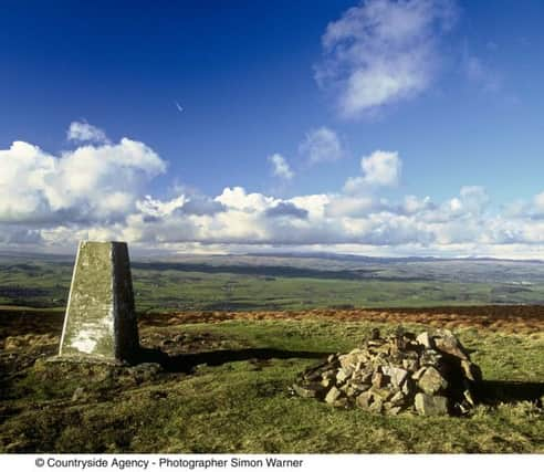
Country & Coast: Exacting work for the precise science of pinnacle profiling


Mountain it most certainly is not, being just a grassy dome encountered on the Pennine Way between the villages of Lothersdale and Thornton-In-Craven. Yet two things elevate it above the ordinary.
One is that the summit commands perhaps the best view of the long southern fringe of the Yorkshire Dales. The other is that lowly Pinhaw, despite measuring just 1,273ft in height, is considered important enough by the Ordnance Survey to have a trig point. That, at least, gives it something in common with the famous Three Peaks of Penyghent, Ingleborough and - the highest point in Yorkshire - Whernside.
Advertisement
Hide AdAdvertisement
Hide AdThese concrete columns always come as a very welcome sight for walkers, marking as they do the end of a long slog up from the dale below. There are almost 6,300 of them in the UK and, standing on Pinhaw Beacon a couple of weeks ago, it occurred to me that the unsung heroes of our high places are those brave souls who in all weathers cursed their way to the tops of every hill and mountain in the land, carrying the construction equipment and materials.
Trig points began to appear in 1936 when the OS began a new survey of Britain’s landscape. At first just a few hundred were built on the highest summits, allowing the use of equipment like theodolites to calculate heights and distances.
By 1962 the network was complete, and the so-called retriangulation of the UK made possible the grid reference system which covered the Ordnance Survey’s new sheets and made map-reading so much more reliable. In some cases OS surveyors spent a couple of weeks camped out on mountain tops waiting for good visibility to complete their calculations.
The results were not without controversy. When the OS got down to analysing what they described as their “reobservations and computations” they had the nerve to lop 4ft off the top of Scafell Pike, England’s loftiest mountain, reducing it from 3,210ft to a shade less impressive 3,206. Even worse, it began to appear on OS maps as a puny-sounding 977 metres.
Advertisement
Hide AdAdvertisement
Hide AdFell walkers like me feared that the next survey, when electronic distance-measuring devices were adopted, would decapitate Scafell Pike yet further and bring it down to below 3,200ft. With sighs of relief, though, we learned that the newly revised figure for the highest point in England actually returned three of those lost feet to its official height.
Nowadays, most of the trig points are redundant, made obsolete by the OS’s GPS network. But walkers still love them. And for me, long before the selfie stick was invented, the concrete posts on summits like Penyghent, Whernside and - another favourite - Tow Scar near Ingleton, served as ideal shoulder-high tripods for my timer-beeping camera.