Country & Coast: Holderness route is best enjoyed right next to the sea


If you want to do more than a couple of miles there it is necessary to take to the beach. Unfortunately, the sturdy footwear we normally use on paths in the Yorkshire Dales or North York Moors is useless in the inter-tidal zone, offering poor grip on slippery rocks and scant protection against oozing mud. If you move higher up, as I did last week, you will find yourself sitting down on a rock and emptying streams of grit from your boots.
Happily, though, plans are afoot to fill this gap in our rights of way network. A route along the clifftops from Wilsthorpe to the village of Kilnsea is at the planning stage and is expected to open by 2020. It will be one of the last stretches of 2,709-mile England Coast Path to be completed.
Advertisement
Hide AdAdvertisement
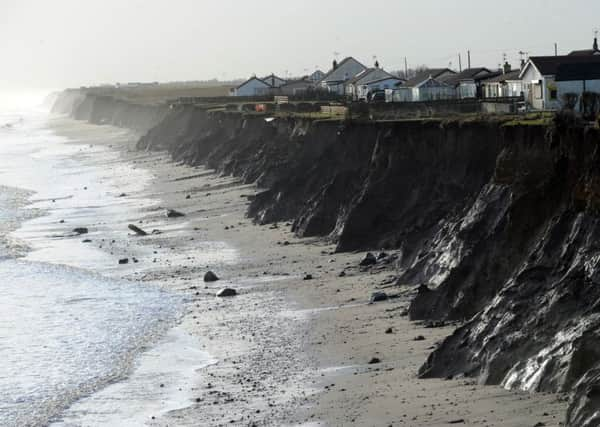
Hide AdThe task is difficult, though, since the Holderness coast is one of the most unstable in the world. In some places the boulder-clay cliffs have retreated by three feet in just one year, a challenging statistic for those attempting to create a public right of way that extends 12ft wide. It is for this reason that a safeguard known as roll-back has been incorporated into the scheme, allowing the path to be relocated back to the next available strip of land should the original route be inconveniently devoured by the advancing waves of the North Sea.
I thoroughly intend to be one of the first to walk the new cliff path when it does eventually open to the public. However, despite the sand and mud I would say the beach is a somewhat more interesting place to take a walk, since the sea reveals its secrets the closer you get to it.
In the space of just a couple of miles I saw what I think were three harbour porpoises offshore and a pair of ringed plovers scurrying along the tideline. There were plenty of razorshells and cockles, a couple of dead burrowing starfish, and the remains of a masked crab, which gets its name from the pattern on its shell looking like a human face.
What I found best about the beach, though, was the opportunity to talk to anglers about what they were catching. With long beachcasters and chunky reels they heaved lines of up to 30lb breaking strain into the surf, using baits like mackerel and black lugworms, which they buy frozen. One angler was using crab and squid on his hooks.
Advertisement
Hide AdAdvertisement
Hide AdThey were catching common dab, a flatfish that is abundant in the North Sea, as well some whiting and flounders.
Another showed me a couple of small thornback rays, also known as “skate”, which he enticed from the muddy seabed.
If they are lucky, anglers here can also hook “doggies” (dog fish) or bass, although the latter must strictly be returned into the sea between January and June.
All of this was fascinating. Next time I walk the beach, though, I will be sure to take some wellies.