SNOW: Severe weather warning for snow issued for Yorkshire from Friday


A blast of cold Arctic air moving over from Canada could bring snow to 'most of northern England', according to the Met Office.
The Met Office forecast has issued a severe weather warning for Yorkshire, to take effect from Friday.
Advertisement
Hide AdAdvertisement
Hide AdIt affects: East Riding of Yorkshire, Kingston upon Hull, North Yorkshire, South Yorkshire and York.
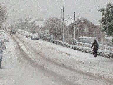
Motorists have been warned to expect disruption.
A spokesman said: "Showers of snow, sleet and hail will continue across parts of the UK. 2 to 4 cm of snow may affect some lowland areas, while high ground may see locally 5 to 10 cm.
"Disruption to transport networks seems likely either due to snow or ice. Additionally, northwesterly gales and large waves will affect some eastern coastal areas, perhaps leading to local over-topping.
"A cold north to northwesterly airstream will keep the risk of wintry weather going through Friday. Some inland areas, sheltered from the northwesterly wind, seem likely to escape most of the showers."
Advertisement
Hide AdAdvertisement
Hide AdNationally, Severe Weather Warnings have been issued for wind and snow, with the heaviest and most frequent snow showers likely across northern and western Scotland, Northern Ireland and around Irish Sea coasts, but eastern coasts will also be affected at times on Friday and Saturday. There will be gales which could lead to temporary blizzard conditions as well as a risk of hail and thunder in some locations.
Paul Gundersen, Chief Meteorologist said: “Most northern areas are very likely to see snow showers at times over the next few days, but the situation over the southern half of England is more complicated.
“Forecasting snow is always challenging and there’s often a fine line between whether it will rain or snow in a particular location depending on slight changes in air temperature. Keep an eye on the forecast and warnings for your area for the latest information.”
DRIVING IN SNOW & ICE
Rod Dennis, of the RAC, said drivers should be prepared for "tricky driving conditions and significantly extended journey times".
Advertisement
Hide AdAdvertisement
Hide Ad"Even a small amount of snowfall has the potential to cause major disruption for motorists. The fact that drivers in some parts of the country will be faced with strong winds, snow showers and icy stretches increases the chances of problems on the road enormously."
He urged drivers to plan their trips carefully and "consider rearranging any non-essential journeys in the parts of the country most likely to be affected by the bad weather", as well as checking tyre tread and pressure, windscreen wipers and screen wash levels.
"When out on snowy roads, always have dipped headlights on and proceed carefully and cautiously. Drive with a very light right foot, and keep your revs down by changing to as high a gear as possible.
"Try to avoid braking and turning at the same time. When approaching a bend in the road, reduce your speed first and then begin to turn. Above all, avoid the temptation to brake sharply as that will make you lose control."
Advertisement
Hide AdAdvertisement
Hide AdAnd of course, there is still a chance of 'thundersnow' in parts of Yorkshire later this week: http://www.yorkshireeveningpost.co.uk/news/thundersnow-could-batter-yorkshire-as-weather-warning-issued-for-snow-and-ice-1-8327099