Yorkshire snow: County braced for weekend of freezing temperatures and wintry showers


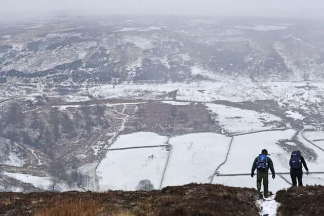
The UK could have the coldest temperature of the winter in the next 48 hours, with up to 4in (10cm) of snow on higher ground in Sheffield and gales in the North East.
Met Office officials also issued weather warnings for the South East, central England and parts of southern Scotland, with icy roads and drifting snow potentially causing problems for those out travelling.
Advertisement
Hide AdAdvertisement
Hide AdHealth officials have warned the elderly and sick to stock up on essential medicines and food ahead of the cold snap.
Temperatures across much of the UK are likely to be just a few degrees above freezing, but with winds from Scandinavia it will feel much more raw, Met Office spokeswoman Nicola Maxey said.
Conditions could conspire to beat the current lowest temperature of the winter so far, the minus 11C (12.2F) recorded at Cromdale in Moray, north-east Scotland, on December 5.
The weather warnings are in force from 6pm on Friday until 10am on Saturday, covering higher ground in the North between Sheffield and Edinburgh, and Kent and Sussex in the South East.
Advertisement
Hide AdAdvertisement
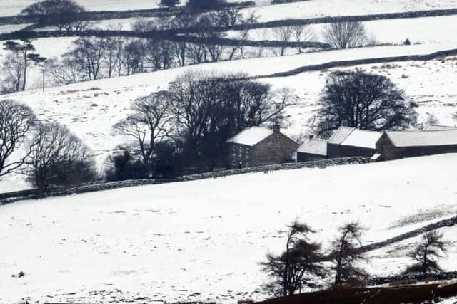
Hide AdLight snow showers were evident across the county last night as commuters woke to tricky road conditions on their way into work.
Temperatures fell below freezing and will stay very cold there for the coming 48 hours with a windchill likely to make today feel like -3C.
Ms Maxey said: "In areas like the Pennines, North York Moors and the Southern Highlands we are looking at lying snow of 3-6cm (1.2 to 2.5in) above 200m and maybe as much as 10cm (4in) above 300m.
"Down the eastern side of the UK we are likely to see snow flurries, sleet and showers coming through, which are likely to turn wintry.
Advertisement
Hide AdAdvertisement
Hide Ad"We could see gales in the North East, with drifting snow, and we could see icy conditions and disruptions to transport, particularly on higher routes through the Pennines."
The cold winds from northern Europe are expected to bring sleet and snow to other eastern areas, but it is unlikely to settle.
Overnight into Saturday there will be widespread frosts, particularly in the West where there will be clearer skies.
The biting wind at the weekend will leave temperatures feeling much colder.
Advertisement
Hide AdAdvertisement
Hide AdFriday will see 2C to 3C (36F to 37F) in the Midlands, London and eastern areas, with temperatures on Saturday between 3C and 5C (37.4F to 41F), perhaps reaching 6C (42.8F) in Scotland.
Public Health England (PHE) has issued a warning amid the plummeting temperatures.
Medical director Professor Paul Cosford said: "With more cold weather across all parts of England, now is the time to really think how it could impact you and your family, particularly those who are very young, over 65 or who have heart and lung conditions.
"Try to keep homes heated to at least 18C (64F), stock up on any essential medicine or food that you need before the cold arrives and remember that you will be warmer wearing several thin layers instead of fewer thick ones."
Here is the Met Office forecast for Yorkshire in full:
Today:
Advertisement
Hide AdAdvertisement
Hide AdA mostly cloudy day with occasional snow showers, especially during the morning. During the afternoon the showers are likely to become more scattered and lighter. Feeling very cold in brisk winds. Maximum Temperature 3 °C.
Tonight:
It will remain cloudy overnight with occasional snow showers continuing. Winds strengthening by dawn and a widespread frost forming. Feeling very cold. Minimum Temperature -1 °C.
Saturday:
Staying cold and mainly cloudy with occasional wintry showers, these perhaps turning heavier for a time through the morning. An increasing wind chill as easterly winds continue to strengthen. Maximum Temperature 4 °C.
Outlook for Sunday to Tuesday:
Staying cold and mostly cloudy Sunday and Monday with wintry showers becoming isolated. Feeling very cold in the brisk easterly winds. Drier and brighter Tuesday with lighter winds. Still cold.