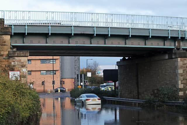
'Flooding is possible': Residents across West Yorkshire warned to be prepared following Storm Jorge
Four flood warnings remain in place on Monday (Mar 2) morning in West Yorkshire.
The Lower River Aire catchment, Lower River Nidd, Tidal River Ouse from Naburn Lock to Selby and Tidal River Wharfe are all at risk of flooding according to the government warning.
Advertisement
Hide AdAdvertisement
Hide AdThe flood alerts state to be prepared for flooding, however river levels are dropping following heavy rain in the last 72 hours.

A total of 82 flood warnings are still in place for England, Wales and Scotland after the effects of Storm Jorge over the weekend.
Ice warnings are also in place for western areas from northern Wales to the top of Scotland, and the western half of Northern Ireland after the storm which helped the UK to its highest February rainfall on record.
The Environment Agency (EA) says 76 flood warnings are in place for England - mostly in the South West, along the Welsh border and in Yorkshire - with a further three such warnings in each of Wales and Scotland.
Advertisement
Hide AdAdvertisement
Hide AdA total of 164 less serious flood alerts - advising of potential flooding - remain active for England, Wales and Scotland.
Although heavy downpours have eased, authorities have advised of possible traffic disruptions on Monday morning owing to the continuing flood situation.
Rail travellers using the West Coast main line have been warned to expect disruptions this week as repairs are made to a section of line near Warrington which was damaged in a landslip on the weekend.
The southbound line at Dutton Viaduct has been closed for the repairs and is expected to be shut for several days, NetworkRail said in a statement.
Advertisement
Hide AdAdvertisement
Hide AdEmergency teams have repaired damaged flood barriers in parts of the West Midlands to prepare for high water levels on the River Severn, which are expected to peak at between 5.4 and 5.7 metres on Monday afternoon, the EA said.
For the first time since the flooding started, there were no reported evacuations in the worst-hit areas of East Yorkshire on Sunday.
Water levels are generally dropping or remaining stable in Snaith, Gowdall, East Cowick and West Cowick, but are expected to remain high for several days, East Riding of Yorkshire Council said.
A UK average of 202.1mm of rain fell last month, surpassing February 1990 when 193.4mm fell, the Met Office said.
Advertisement
Hide AdAdvertisement
Hide AdLocal authorities will be faced with significant clean-up operations once flooding risks subside and water levels reduce.
Thousands of homes and businesses were flooded as areas were deluged by more than a month's worth of rainfall in just 24 hours, while some 127,000 properties were protected by flood defences this winter, authorities said.
Some 15 rivers in the Midlands, Yorkshire and Lancashire recorded their highest levels on record and the Environment Agency warned the country needs to brace itself for "more frequent periods of extreme weather like this" because of climate change.
The downpours, which started with Storm Ciara and continued with Storm Dennis and then Storm Jorge, contributed to record river levels which saw hundreds of emergency staff working on flood defences and pumps, clearing debris and repairing damaged defences across the country.
Advertisement
Hide AdAdvertisement
Hide AdThe Government has said it is investing £2.6 billion in flood defences by 2021.
More than 3,300 properties in England are thought to have been flooded as a result of the combined effects of storms Ciara and Dennis, the Department for Environment Food and Rural Affairs said.