Bike Route: The Wolds held a few surprises


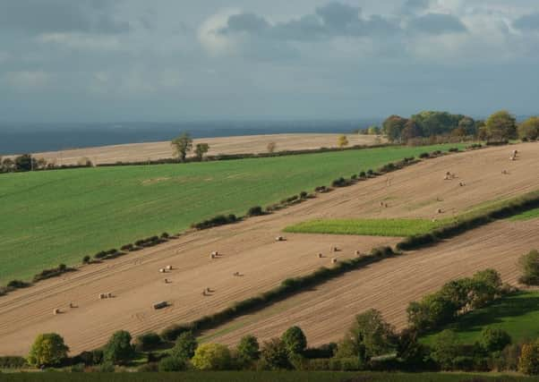
After tackling two really hard loops for my last two columns I thought I’d designed a pan-flat route this time around. I was surprised to find then that the first half of this week’s ride was anything but, and it took me on some of the best and most varied roads I’ve encountered right on the western edge of the Yorkshire Wolds.
1.During my 20s I lived in Howden for three years but never really ventured east of it apart from the odd trip to Hull. The only roads I’d ever pedalled on around the town were as flat as a proverbial pancake and I assumed that would be the case when I pulled up in South Cave. I realised I’d been rising steadily to Drewton. I thought that might have been a fluke but the road continued to undulate for the next seven miles, all the way into Sancton. When I descended into Market Weighton I figured that would be that, but no, it was merely the start.
Advertisement
Hide AdAdvertisement
Hide Ad2. I exited Market Weighton to the north and picked up my first single-track road as I descended off Intake Hill. My first really significant climb came immediately after as I headed up through Londesborough on the hill bearing its name. The views up to that point had been good, but this ascent took them to a whole new level and I could see for miles as I peered out over the flatlands to the west. Ice was still covering much of the shaded patches of road and that worried me as I dropped into Nunburnholme.
3. The backroad to Warter was a little muddier than I’d have liked but it was relatively flat before undertaking what proved to be my biggest climb. This was several smaller rises combined over seven miles, but a lack of descending in between resulted in a long, gradual slog. I then passed through Huggate. Once I’d reached the summit, I was rewarded by one of the most fun descents I’d experienced all year. Givendale Hill was wide and deserted and bathed in sun, and I flew round its sweeping bends with a confidence that had eluded me earlier in the day. The gradient flattened out nicely as I headed down The Mile into Pocklington.
4. I headed out of town on the same road as Burnby Hall Gardens, and once I’d crossed York Road I was surrounded by farmer’s fields. A lack of wind made for hassle-free progress. The quaint villages of Bielby and Evelingham passed in quick succession and I even had the chance to survey a large pig farm before I’d made it to Harswell.
5. My progress was temporarily put into jeopardy when I reached North Cliffe. I wanted to take Cliffe Road down to North Cave but was met with a road closed sign. Unimpressed by the prospect of a 14-mile detour, I chose to risk my original passage and although I was stopped by a roadworker, I convinced him to let me past. The surface was rough but rideable and I breathed a sigh of relief once I’d made it back on to the open road and I was soon back in South Cave. I’ve done some post-ride research and all being well Cliffe Road should be open again by now.
Difficulty Rating: HHHHH
Time: 3 hours 2 minutes (at 15mph average speed)
Distance: 45.5 miles (73.5km)
Free parking: Church Street Car Park in South Cave.
Grid Ref: SE 92302 31159.
Public toilets: Located on Londesborough Road in Market Weighton
Download the GPX file: https://we.tl/AblPlyXsxX