Incredible 16th-century map of Yorkshire likened to a Shakespeare first edition goes on display in Leeds
In fact, the creator of one of the first UK atlases ever created depicted the county as twice the size of England and Wales.
Now this incredibly rare copy will be going on display at a library in Leeds.
Advertisement
Hide AdAdvertisement
Hide AdContaining 35 detailed, hand coloured maps of the counties of England and Wales, the fascinating book was created by the Yorkshire-born ‘father of English cartography’ Christopher Saxton in 1579 after getting royal permission from Queen Elizabeth I.

Having also secured the financial backing of the monarch’s master of requests Thomas Seckford, in 1574 Saxton set about the daunting task of touring the whole nation to survey every county and collect all the minute detail he needed to bring his atlas together.
His finished work, which he dedicated to The Queen, was completed in 1578 and after it was published the following year, it became the foundation for county maps for more than a century after.
In fact Saxton’s Atlas was not fully replaced as the definitive geographical representation of England and Wales until Ordnance Survey began publishing one-inch maps in 1801.
Advertisement
Hide AdAdvertisement
Hide AdThe atlas’s pages feature ‘Ledes’ and ‘Bradforthe’, the old names for Leeds and Bradford, and Saxton himself was believed to have been born in Dewsbury in the early 1540s before moving to south Leeds.
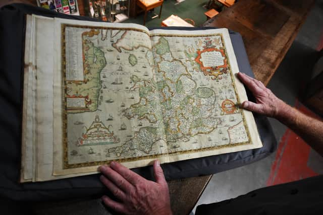
Whilst most of the maps within the atlas were engraved on single copper plates, Saxton decided Yorkshire was important enough to require two, making the map of his home county twice the size of that of England and Wales.
The book itself is so rare and cherished by experts, it has been compared to a map-collector’s version of the first folio of Shakespeare, and the esteemed cartographer Thomas Chubb said that for any map-enthusiast, it would be the “chief jewel and the crowning glory of the collection.”
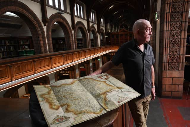
Philip Wilde, library assistant at Leeds Central Library has been researching the atlas. He said: “This remarkable collection of maps was the very first time anyone had comprehensively mapped the counties of England and Wales in this way, and Saxton’s diligence, dedication and eye for detail completely transformed our understanding of the entire nation.
Advertisement
Hide AdAdvertisement
Hide Ad“We’re extremely lucky to have such an important book in our collection both to study and for our visitors to see.
Librarians at Leeds Central Library have been working with their precious copy of Saxton’s astonishing book and the atlas will be available to see alongside other historic maps during a special heritage open day event at the library on September 9.
Saxton’s Atlas is also available to view by appointment for visitors. Visit the Local and Family History department on the second floor of Leeds Central Library. Two forms of ID (one with your name and another with your address) and at least 24-hour’s notice will be required.
Call 0113 378 6982 or email [email protected] for further details and to book an appointment.