Leeds wheels in motion

Among these were the development of Briggate, the widening of Boar Lane, Duncan Street and Vicar Lane, and the creation of New Market Street and the Headrow.
After the Second World War, it was quickly realised that the rapid growth of motorised transport would soon bring havoc to many UK town and city centres if the problems were not examined in detail. In 1960, Ernest Marples, Transport Minister in Harold Macmillan’s government, commissioned a team, headed by the architect, civil engineer and planner Professor Sir Colin Buchanan, to produce the report Traffic in Towns, which was published in 1963.
Advertisement
Hide AdAdvertisement
Hide AdThe report offered ways to mitigate congestion as well as giving town planners a set of policy blueprints to deal with its effects on the urban environment. These included traffic containment and segregation that could be balanced against urban development, new corridor and distribution roads and precincts. In the early 1950s, there were 10.5 million vehicles registered in the UK, though, at the predicted growth rates, this number was expected to become 18 million by 1970, 27 million by 1980 and 40 million in 2010.

Buchanan looked at the potential traffic problems in several areas including the Oxford Street area of London, Newbury and Leeds. Looking closely at Leeds, Buchanan made some disturbing conclusions and recommendations which were never completely carried out.
Leeds’ traffic problems had already been noted by Charles Geoffrey Thirlwall, who was appointed as Leeds Council’s deputy city engineer in 1959. With a keen interest in motorway building, redevelopment of city centre land and inner city housing, he was to have an enormous influence on how Leeds moved forward.
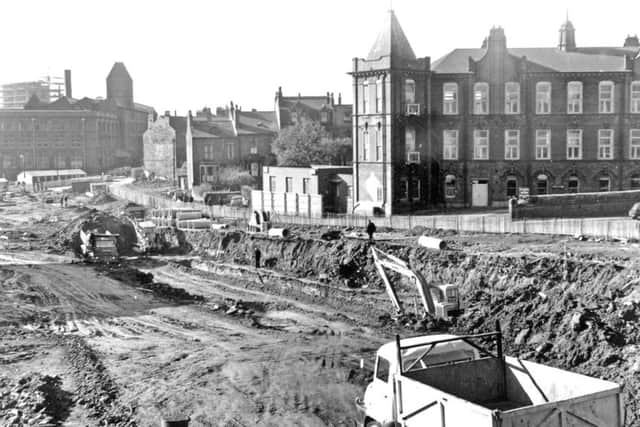
In 1960, Thirlwall produced a report suggesting a system of urban motorways for the city and four years later work started on the Leeds Inner Ring Road. The task would be carried out in a number of stages and they would eventually connect east and west areas via a northern arc flowing round the city. It was somewhat fortunate that the line of the road cut though large areas of condemned housing and obsolescent industrial properties. But the work still involved the demolition of over 300 houses as well as the clearance of commercial properties.
Advertisement
Hide AdAdvertisement
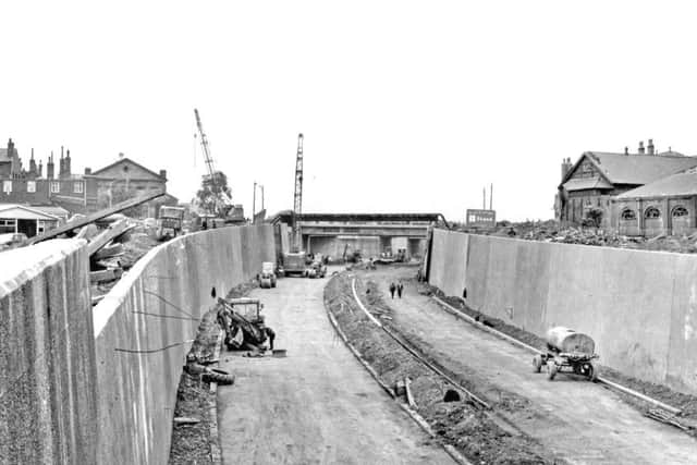
Hide AdStage one of the project, begun in July 1964, extended from Westgate at the south-west to an area between Woodhouse Lane and Claypit Lane – a distance of some 3,600ft which cost around £2m to undertake. This section was the first “sunken” urban motorway in Britain, with a portion in a cutting and another travelling 400 yards through twin tunnels.
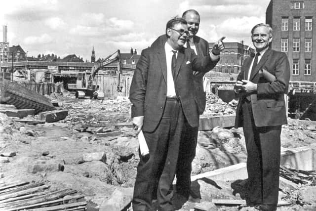

On August 6, 1965, Minister of Transport Tom Fraser visited Leeds to see for himself how the project was progressing. He predicted a “special partnership” would be forged between Leeds and his ministry.
On January 14, 1967, during the opening day of the Inner Ring Road Stage I, pedestrians were allowed to walk along the stretch for an hour.
Alderman JS Walsh, Lord Mayor of Leeds, officially opened Stage I at 5,15pm. He was accompanied by the Lady Mayoress and they drove from the Westgate end of the road in a single-deck Corporation bus to perform the tape-cutting ceremony. About 350 people had gathered there and heard Ald Walsh say he was very proud that this historic event had occurred during his year of office. He added: “The Inner Ring Road will be a tremendous contribution to alleviating traffic problems in Leeds and is a magnificent feat of engineering, special lighting and safety devices.”
Advertisement
Hide AdAdvertisement
Hide AdHe mentioned the measuring of air impurities in the twin tunnels and the TV cameras. “It is unique in urban motorways that the whole flow of traffic on both roads will be continuously observed by police at their Westgate headquarters,” he said.
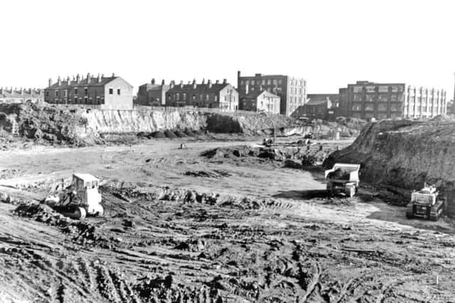

General information concerning Stage I stated: the two carriageways were 24ft wide; central reservation, 10ft wide; side verges, 5ft wide; radius of road, 1,860ft; excavation, 350,000 cubic yards; total concrete, 50,000 cubic yards; reinforcing steel, 1,600 tons.
When constructed, Stage II of the road would proceed eastwards to provide a direct link to the Sheepscar area of the city where a number of very heavily trafficked commuter radial roads converged. The road extended from the Claypit Lane area through to York Road, crossing the Eastgate-Regent Street by a flyover and opened in May 1970.
Stage III was projected to underpass Westgate roundabout, over pass Wellington Street and extend southwards across the River Aire. This came into operation from November 1974. Stages IV, V and VI were developed from the late 1980s.
Advertisement
Hide AdAdvertisement
Hide AdThe Yorkshire Evening Post on October 29, 2008 announced that the Leeds Inner Ring Road was finally completed – more than 40 years after the work began. The final section – Stage VII – featured the 500-metre-long John Smeaton Viaduct (formerly Hunslet Viaduct).

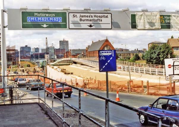
Presently, the Inner Ring Road goes some way to improve travel times across the city and relieve congestion in Holbeck, Hunslet and south of the city centre. It meanders its way round the city centre from the M621 at the Leeds United ground in the west, across the River Aire, through the tunnels to the north of the city centre. On leaving the A64 York Road, it swings south-east and crosses the River Aire at Richmond Bridge before reconnecting with the M621 after passing over the John Smeaton Viaduct.
Thanks to Leeds Library staff for help with this piece.