A year ago, the Yorkshire Dales National Park was extended, but what happened next?


As the crow flies, the quiet country road on which Stevie Hastie is standing lies roughly 15 miles inside Cumbria from the North Yorkshire border. But beside him on the grass verge, a new metal sign informs drivers they are about to enter the Yorkshire Dales National Park.
Eventually, 10 of these signs will appear on Cumbrian roads, all part of the process of bringing the best part of 160 square miles of the county into an already huge national park that reaches as far south as Bolton Abbey on the edge of industrial West Yorkshire.
Advertisement
Hide AdAdvertisement
Hide AdIntroducing the Yorkshire name to a landscape so far within its neighbour’s territory could be a problem, acknowledges Steve, who is the national park’s area manager, and is being done with great sensitivity. Thus, on this back road outside the village of Maulds Meaburn the sign resurrects the name of Westmorland, a still fondly remembered county abolished with Cumberland 40 years ago to create Cumbria. It has turned out to be a PR masterstroke.
“Any misgivings people had seem to have been addressed by what we’re doing,” Steve says. “I think the idea of this area being associated with the Yorkshire Dales has now been received positively by local people. In fact, we involved them in the placing of our boundary signs.”
When first mooted, the introduction of the Yorkshire Dales brand to a large chunk of Cumbria was viewed as a shotgun marriage by some. It took a public inquiry in 2013 for consent to finally be given, and up to £1.2m a year will be spent turning the area into an extension of the national park.
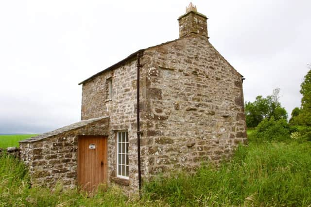
The change took effect last August 1st, and on that day the Dales’s brag list of scenic gems was lengthened to include the lovely Orton Fells, which the Lake District National Park had forcefully tried - and failed - to annex. Driving around there, you experience the illusion of having accidentally wandered into a parallel universe to Ribblesdale and Malhamdale in the “old” national park, so similar are the gleaming white scars and sheets of bone-white limestone pavement.
Advertisement
Hide AdAdvertisement
Hide AdInto the Dales fold, too, came the dramatic glacial valley of Mallerstang with its spectacular eastern face of Wild Boar Fell, favourite climb of the Pennine Way creator Tom Stephenson, as well as the northern side of the Howgill Fells, inexplicably left out of the national park when it was created back in 1954. And in came a whole host of villages no less picturesque than well known staples of Dales calendars like Grassington, Malham, West Burton and Reeth.
But last year’s Yorkshire Day acquisition of the extended territory was never meant to usher in all the bells and whistles of a national park overnight, such as footpaths bristling with signs and new information centres sprouting up in the larger villages. Instead, the first priority was to establish a base for operations, eventually found at a former gallery in the village of Orton, and a workshop for all the fingerposts, gates, stiles and other paraphernalia of public rights of way.
Steve himself didn’t take up the job of area manager until October, and was later followed by three members of staff and the recruitment of 24 Dales volunteer rangers. It wasn’t until April this year that any kind of visible Yorkshire Dales presence was created.
He is well qualified to appreciate the similarities between the new area and what he calls the “established park”, having previously run the successful Three Peaks project to deal with huge visitor pressures on and around the summits of Penyghent, Whernside and Ingleborough.
Advertisement
Hide AdAdvertisement
Hide Ad“Moving across here has been a big discovery for me,” he says. “It is no less an impressive landscape than the national park everyone knows, but also has its own unique charms. One characteristic which strikes me is that a large part of its history was shaped by the landscape being one of transit. People moved through here to get from one part of the north of England to another, like the old drovers. You can see their legacy in so many of the roads, which are now single track ribbons of tarmac with unusually wide verges.”
From early medieval times, huge numbers of cattle were driven from Scotland to be fattened in the gentler, greener pastures of the Yorkshire Dales and had to pass through the Orton Fells on the way. The roads - known as “drove ways”, “drove roads”, “ox roads” and “drift ways” - are a special feature of the area that Yorkshire Dales National Park status will promote. One of the roads is considered so rich in wildflowers along its verges it will be turned into a linear nature reserve.
The history of the area is even richer than that in the established national park. The stroke of a pen which created the new extension has been responsible for a 50 per cent growth in the number of scheduled monuments inside the national park. They include the gaunt ruin of Pendragon Castle which looms above the River Eden. Said to have been built by Uther Pendragon, father of King Arthur, it was later home to Hugh de Morville, one of Thomas Beckett’s murders, and favourite residence of Lady Ann Clifford from Skipton Castle. Nearby is Lammerside Castle, a 12th century fortification against Scots invaders.
Then there are smaller curiosities like the so-called Dame School, built in 1780 by three yeoman farmers to educate children in the remote area, and the world-famous Fox’s Pulpit, where George Fox preached to 1000 people for three hours in 1652 and founded the Quaker movement. Above the village of Crosby Ravensworth stands the Black Dub monument marking the spot where Charles II rested his army in 1651 while marching from Scotland to retake the English throne. There is even a magnificent railway viaduct at Smardale Gill near Kirkby Stephen, shorter than the iconic structure at Ribblehead but almost two decades older.
Advertisement
Hide AdAdvertisement
Hide AdWith so many attractions brought under the Yorkshire Dales brand the early focus has been on preparing for the eventual influx of visitors. The work by Steve and his colleagues has concentrated on surveying the rights of way network to find out its condition. Only 66 per cent of footpaths and bridleways have been found to be up to standard, spending cutbacks having taken their toll, and so there will be a major overhaul of the network over the next few years.
So far, local parish councils and pub landlords report there are more visitors around than last year, but at the moment there is no way to record just how many.
“It’s difficult for us to gauge the increase, because we don’t know what it was like before,” Steve says, “but we are hearing comments about more people being in pubs and more cars around, so that’s probably a good thing. However, tourism in Cumbria has been up everywhere this year so I’d be surprised it if was purely down to national park designation.”
Another big issue given priority in the new extension is planning matters. One of the main fears expressed at the public inquiry was that it would be harder to get planning permission for building work when the area became a national park. To help the process, planning surgeries are held once a fortnight at the village of Orton, with others are planned for Kirkby Lonsdale to the south.
Advertisement
Hide AdAdvertisement
Hide AdNothing contentious has yet arisen, according to Steve’s boss, the national park’s chief executive David Butterworth. And he points out that landscape in the new area is now better protected than before from certain types of developments. If someone came forward with a wind farm proposal, for example, it might have been accepted before last August. Now, though, it would stand no chance because it is government policy to keep wind farms out of national parks.
As far as books and leaflets about the area go, one year on there is virtually nothing to guide visitors. It will take time for the publishing industry to produce anything like the library of books that already exists for the rest of the Yorkshire Dales. Even Ordnance Survey maps have yet to catch up with the new national park boundaries.
“The key thing for me,” says David, “ was to recognise that there’s a learning curve for everyone in the area. I was very keen not to be seen going in wearing a pair of size 15 boots, taking a bullish stormtrooper approach. We’ll listen to those who live and work there and then develop our approach whether in terms of producing leaflets, organising guided walks or the rest. It’s a subtle approach, but I think it’s the right one.”