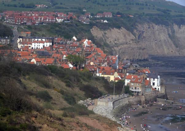
Following in famous footsteps


Country Walking magazine named the route from St Bees Head in Cumbria to Robin Hood’s Bay on the Yorkshire coast the second-best walking experience on the planet – beaten only by one in New Zealand – but Chris Grogan didn’t need any official blessing to appreciate its excellence.
“There’s a romance about it for sure,” she says. “Doing the Coast to Coast for the first time back in the 1990s is still in my mind one of the top memories of my whole life. It was emotionally very powerful to walk from one side of my country to the other.”
Advertisement
Hide AdAdvertisement
Hide AdShe and her husband Tony have now completed the 190-odd mile path three times, most recently for the purposes of writing a new guide to the route. They are well-known in the walking world as the creators of the 90-mile Dales High Way which starts near their home in Saltaire, Bradford, and finishes at Appleby-in-Westmorland.
Since being devised by the Lakeland guidebook author Alfred Wainwright in 1973, the precise line of the C2C, as it has become known, had been altered in numerous places. The Grogans’ new book is the first one to describe the final course.
It runs across three National Parks – the Lake District, Yorkshire Dales and North York Moors – and is divided into 12 daily sections. The longest is a 23-mile stretch across the flat Vale of Mowbray from the town of Richmond to Ingleby Cross on the edge of the North York Moors, while the shortest is a lovely 11-mile moorland traverse of Swaledale from the timeless hamlet of Keld to the picturesque village green at Reeth.
With an estimated 7,000 people now completing it every year, the C2C is thought to be the most popular long-distance walk in the UK, eclipsing even the mighty Pennine Way.
Advertisement
Hide AdAdvertisement
Hide AdAlfred Wainwright, in fact, came up with the idea for the Coast to Coast route after he had returned from the Pennine Way because he wanted his next major walk to be more enjoyable. After doing the 270-mile hike from Edale in the Peak District to Kirk Yetholm in the Scottish Borders he had complained of floundering in peat bogs, stumbling in soggy heather and squelching in muddy fields. Four years later, when he published his A Coast to Coast Walk guide, he remarked: “I finished the Pennine Way with relief, the Coast to Coast with regret.”
Almost immediately his book ran into problems with some farmers and landowners along the course of C2C.
In several places he had ignored the inconvenient truth that there was no legal right of way.
For Tony and Chris Grogan, producing their guide to Wainwright’s walk meant working closely with rights of way officers in the National Parks and local councils.
Advertisement
Hide AdAdvertisement
Hide AdSays Tony: “Probably because Wainwright’s home stamping ground was the Lake District, where you can walk anywhere above the intake walls, he kind of took that mentality to places in the Pennines and Yorkshire Dales where it just wasn’t the case. But, strangely enough, when the Right to Roam law came into effect in 2000 some parts of his original route finally became legal, so maybe he was ahead of his time.”
Wainwright died in 1991 at the age of 84, but in 2010 his publishers produced a revised edition of his book to reflect route changes. Since then amendments have been made to the route described there, and these are included in the Grogans’ book. However, for Wainwright purists his original route is shown on their maps, where it is accessible.
When the Grogans first completed the C2C almost 20 years ago they carried big packs of camping gear and got rained on every single day. But the weather soon became insignificant, Chris says, while another factor was the camaraderie which developed with others doing the walk.
They all managed to meet up for the grand finale at Robin Hood’s Bay and a drink in the Bay Hotel, right on the finishing line.
Advertisement
Hide AdAdvertisement
Hide AdChris concedes that their own Dales High Way walk, like every other long-distance path in the UK, has an arbitrary starting and finishing point, while the C2C is unique because it is defined by the geography of England.
“When you reach the Yorkshire coast you just can’t walk any further. When they set out from St. Bee’s many people like to dip their feet in the Irish Sea, and when they reach Robin Hood’s Bay they get their boots off for a paddle. Standing there with your feet in the water gives you a wonderful sense of achievement.”
Route guide available now
A Coast to Coast Route Guide by Tony & Chris Grogan is published by Skyware, price £9.99. Available from bookshops and online at www.skyware.co.uk
For up-to-date information about any temporary route diversions, accommodation, baggage carriers, public transport etc, visit www.coastto.co.uk