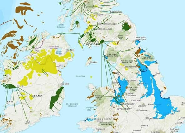
Online map shows grip of Ice Age on UK


The map at www.briticemap.org lets users type in a postcode to see nearby landforms such as glacial debris which records the margin of the ice sheet.
Dr Jeremy Ely, of the university’s geography department, said: “The landform information tells us about how the last British-Irish ice sheet behaved. We can see how it dammed rivers, creating large glacial lakes which covered Manchester, Doncaster and Peterborough.
Advertisement
Hide AdAdvertisement
Hide Ad“Corridors of fast flowing ice, flowed toward the east over Edinburgh and toward the west over Glasgow. Ice also covered Ireland, flowing through the Irish Sea, where it coalesced with Welsh ice, causing it to flow southward to the Isles of Scilly.”
The map is the result of six years’ work by researchers.