Dismay after Flamborough Head is left off new map of area of outstanding natural beauty sites
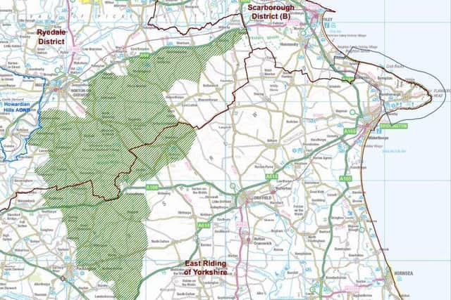
Natural England has started a consultation, which includes a map showing that an area within North Yorkshire would make up more than half the new AONB, linking up with the Howardian Hills AONB.
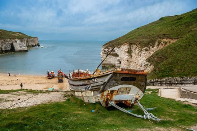
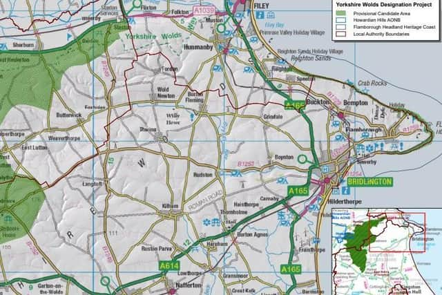
Although the towering white cliffs and beaches of Flamborough Head are shown on the map, the rolling countryside inland, the village, as well as Bempton and Buckton – all in an area already designated a Heritage Coast for its natural beauty, wildlife and heritage – are omitted.
Advertisement
Hide AdAdvertisement
Hide AdVillages like Wold Newton, Thwing, Rudston and Kilham are also left out of the “provisional candidate area”, as well as the market towns of Driffield – known as the “Capital of the Wolds” – Pocklington and Market Weighton.


East Riding Conservative councillors say one of the main drivers for pursing AONB status was for Flamborough to be given extra protection from being overrun by tourism developments.
The late Bridlington Councillor Chad Chadwick had been a strong force behind the council’s application.
As the first round of consultation gets underway today, Coun Leo Hammond called on residents to get involved and “push back” against Natural England’s “conservative” approach.
Advertisement
Hide AdAdvertisement
Hide AdHe said: “As far as I’m aware Natural England have identified that the coast is of AONB worthiness, the issue they have is that the area between the coast and the other part of the Wolds they want to designate is not up to scratch. My view is that’s not acceptable and all the northern section of the Wolds needs to be included.


"Flamborough was one of the main reasons we wanted this in the first place.
"Natural England think the beaches and cliffs (at Flamboorugh) are worthy of the status but because they are detached from the main area, they are not putting it in, as I understand.
“If you get AONB status it gives a massive boost in the strength of the policy to defend the coast from the wrong kind of development and over-development.
Advertisement
Hide AdAdvertisement
Hide Ad“The majority of the Yorkshire Wolds is in the East Riding, not the North Riding, and I’m not happy that they seem to be getting more of the AONB. It is not fair given that East Riding Council has put in the majority of the legwork. We are pushing back against that – we think our part of the Yorkshire Wolds should be designated AONB.


“Pretty much the entire northern strip of the East Riding is what we would like to be included. AONB isn’t just about beautiful landscapes, it’s about heritage too. Driffield and Market Weighton definitely deserve to be in it too.
“Residents need to start getting involved and saying why areas should be in the AONB, bringing local heritage and landscape assets to Natural England’s attention.” Treasurer of
Flamborough Residents Association David Moore said it was “bizarre” that the area’s “jewel in the crown” had been missed out.
Advertisement
Hide AdAdvertisement
Hide AdMr Moore said Natural England needed to go back to the drawing board – saying the map looked as if it had been done by people who didn’t know the area.
He said: “It’s the rocky area at the bottom of the cliffs they are trying to designate – more sea than ground. It is bizarre. As to the rest of it there are areas all over the Wolds that they’ve left out which are equally as beautiful as those included in the provisional candidate area.”
Comment Guidelines
National World encourages reader discussion on our stories. User feedback, insights and back-and-forth exchanges add a rich layer of context to reporting. Please review our Community Guidelines before commenting.