Humber tidal barrier five times the size of the Thames's still an option to protect swathes of land


The barrier was first proposed in 2019 as part of a long-term strategy for the Humber, which involves a dozen councils as far inland as Gainsborough, Selby and Doncaster.
The last time it was seriously considered was in the 1980s, but more intense storms, as a result of climate change and rising sea levels means conventional approaches won’t be enough in future, said Helen Todd, Humber Strategic Manager for the EA.
Advertisement
Hide AdAdvertisement
Hide AdSpeaking ahead of today's 70th anniversary of the tidal surge of 1953, Ms Todd described reaction to the idea as "Marmite": “People either love the idea or think it is unrealistic.”
She said it could gain more traction if it fulfilled multiple objectives - for electricity generation, as transport infrastructure or for ports and navigation.
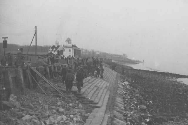
The 1953 surge - caused by high natural tides, a major coastal surge and very high winds - struck the Netherlands, north-west Belgium, England – where it killed 307 people in Lincolnshire, Norfolk, Suffolk and Essex. Less than two decades on, the surge of 1969 caused severe flooding in Hull and led to the construction of the city's tidal barrier - now used around 30 times a year.
In 2013 a surge flooded 7,000 hectares of land and 1,100 homes and businesses on the Humber, but could have been far worse had there been strong winds. “We were incredibly fortunate,” she said.
Advertisement
Hide AdAdvertisement
Hide AdThe city is far better protected now, with huge lagoons to store floodwater in the hinterland and the £42m tidal wall, which was officially opened in 2022.
One of many unanswered questions is where the barrier would go - the further up the estuary the narrower it gets and the cheaper it would be. She said: "The work we are trying to do at the moment is part of (the) Humber2100+ (strategy) which is around agreeing across the partners what the level of flood risk is now and in the future.
"We have to agree on a common problem prior to deciding what we collectively do about it.
"Step two is around agreeing the approaches. Do we agree as partners that the barrier needs to be on or off the table?
Advertisement
Hide AdAdvertisement
Hide Ad"We can't just carry on building defences higher and higher around the estuary. It doesn't work. The higher you build the walls, the higher the water is at the front of the houses, and the bigger the risk if they fail, therefore we need to think of other ways of managing the risk."
Another area being explored is large-scale storage of floodwater on land, as happens at Alkborough, on the Humber’s south bank, whose 400 hectares acts as a reservoir during high tides.
"With flood storage you can achieve multiple benefits," she said. "There's a whole lot of washlands up the Aire and the Ouse. They could be used to create habitat.
"There's potential for carbon sequestration. It comes back to working together to get an answer that solves multiple problems."