Picture special: More snow unlikely but freezing temperatures expected to continue across Yorkshire


This article contains affiliate links. We may earn a small commission on items purchased through this article, but that does not affect our editorial judgement.
Parts of Yorkshire had a blanket up to 5cm deep as chilling temperatures and flurries swept across most of the country.
London and Manchester received a light dusting overnight on Saturday with the Met Office stating the corridor of snow swept down from Scotland, through the Pennines and Cumbria, the Midlands and across the capital and West Sussex.
Advertisement
Hide AdAdvertisement
Hide AdThe most snow seen in the south was 2cm in High Wycombe, while on higher ground near the Pennines as much as 15cm of snow fell.
Forecasters said few places in the east of the country experienced temperatures above zero last night, with residents of Kinbrace in the Highlands contending with jaw-dropping lows of -11.8C.
A Met Office spokesman said: “It was a cold night Saturday and for a few places down towards the Pennines, central East Midlands and passing over the south and east of England, there has been some snow as well.
“You can almost cut the UK in half along the Pennines, with temperatures in the South West reaching up to 10C, 8C in Northern Ireland and between 6C and 7C in the west of Scotland.”
Advertisement
Hide AdAdvertisement
Hide AdNot everywhere in Yorkshire was hit by the white stuff, while Harrogate experienced a hefty flurry through the night, the York and Wetherby areas missed out with just a light dusting.
Tonight will see less snow fall across the country, with only Lincolnshire and Humberside expected to see any white coverage.
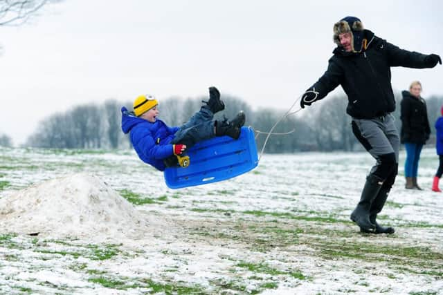
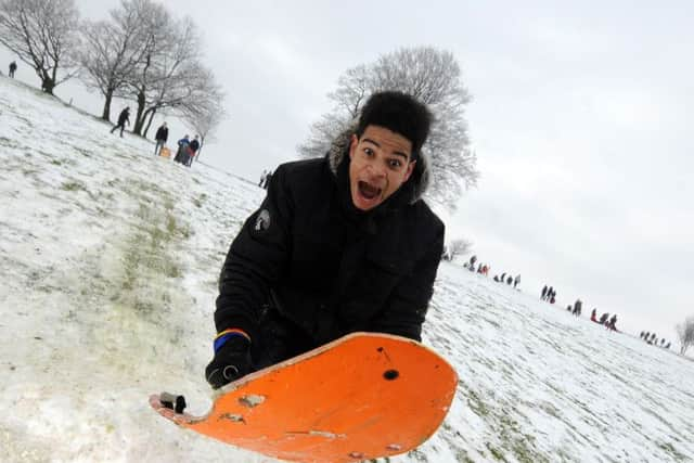
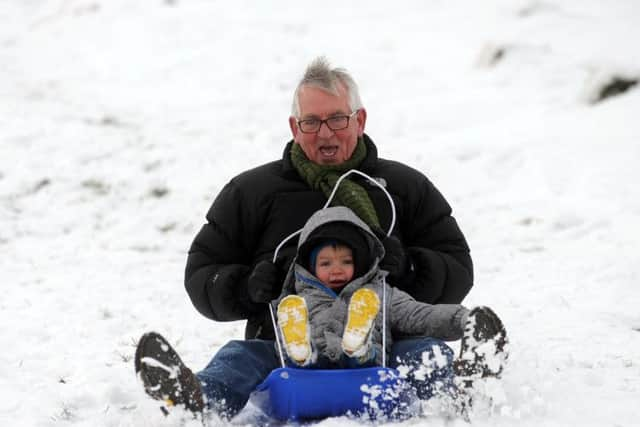
It didn’t take long for children of all ages to make their way out to Yorkshire’s parks, sledges in hand, to make the most of the conditions as our pictures here prove.
Your Yorkshire weather forecast...
Sunday evening and Tonight:

Mainly dry and cold with light winds. Some frost at first, especially in the east and hills, but cloud should thicken through the course of the night, perhaps with a little light rain or snow, especially in the west. Minimum Temperature -2°C.
Monday:
Advertisement
Hide AdAdvertisement
Hide AdCold with large amounts of cloud and some occasional light rain or snow in places. Drier and perhaps brighter during the afternoon as cloud starts to thin. Light winds. Maximum Temperature 3°C.
Outlook for Tuesday to Thursday:
Remaining cold. Cloudy with some light rain or snow Tuesday morning, then becoming mainly dry and bright later and through Wednesday. Widespread overnight frost. Windier with some rain arriving Thursday.