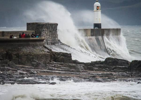
Christmas Eve severe weather warnings as Storm Barbara batters Britain


Severe weather warnings remain in place for Christmas Eve, with a Met Office warning of wind, snow and ice for northern parts of the country.
Gusts reaching almost 120mph were recorded on the summit of Cairn Gorm at 11am on Friday while gusts of 76mph were recorded on Fair Isle and 75mph at Mona on Anglesey in Wales in the late afternoon.
Advertisement
Hide AdAdvertisement
Hide AdThe storm caused widespread disruption with cancellations and revised schedules for ferry services, while revised timetables were in place on the railways.
Thousands of Scottish and Southern Electricity Networks (SSEN) customers were left without power for a time on Friday.
The company said the most significant incident resulted from a lightning strike which affected around 13,000 customers in Lewis and Harris, though all homes were reconnected within two hours.
SSEN said that by 10.30pm engineers had restored power to more than 19,000 homes.
Advertisement
Hide AdAdvertisement
Hide AdThe Met Office has issued yellow “be aware” warnings for Scotland’s central belt and northwards on Saturday, warning of wintry showers affecting large parts of Scotland during Friday evening and night onwards into Saturday morning.
The most frequent snow showers are expected to fall north of the Central Belt with 5-10cm of snow possible on higher ground.
Festive travellers have also been dealt another blow with another storm on the way.
An amber alert for Storm Conor has been issued for the far north of the country on Boxing Day.
Advertisement
Hide AdAdvertisement
Hide AdDean Hall, a Met Office forecaster, said: “There will still be strong winds associated with Storm Barbara affecting the north of Scotland overnight and into Saturday morning.
“For Christmas Eve there is a north/south split across the UK. We still have very gusty, squally conditions across much of Scotland and the north of England and Northern Ireland with further showers, some heavy at times and turning wintry over higher ground.
“Through the day the next weather system is coming in which is the start of Storm Conor that’s going to bring more persistent rain in Northern Ireland, Western Scotland and North West England.
“That will herald the arrival of Storm Conor through Christmas Day but the main impact will not be realised until Boxing Day.
Advertisement
Hide AdAdvertisement
Hide Ad“On Christmas Eve England and Wales will get away with a much drier and brighter day.”
The Scottish Environment Protection Agency issued eight flood warnings for Tayside, the Borders and Easter Ross and eight flood alerts across Scotland on Friday.
Scotland’s transport minister Humza Yousaf MSP said: “We would urge everyone to check the latest sources of information before they travel and keep in mind that the situation can change quickly.
“They should leave plenty time to get to where they need to be and the transport operators are doing what they can to help people arrive at their destinations and get any last minute festive shopping done safely.
Advertisement
Hide AdAdvertisement
Hide Ad“We shall be continuing to monitor the situation over the festive period including Christmas Eve, Christmas Day and Boxing Day to make sure that the most reliable and relevant information is being communicated to people as early as possible.”
Ferry operator Caledonian MacBrayne said more than half of the company’s network saw services cancelled for the duration of Friday while others were suspended and under constant review for any weather windows.
People can call 105, a free new national phone line, if the weather damages their local power network and affects electricity supply.
The number is available to people in England, Scotland and Wales, regardless of who they buy electricity from.