Storm Eunice Leeds, York, Sheffield and Yorkshire coast: Travel disruptions and high winds expected
With Storm Dudley over and Eunice still yet to hit, there is still plenty to be aware of across Yorkshire as the weather begins to get worse.
The Met Office had issued an amber warning for strong winds covering central Scotland, parts of Northern Ireland and northern England above Hull over the evening, with yellow wind warnings in place as far south as Birmingham.
Advertisement
Hide AdAdvertisement
Hide AdIts is also thought that we could see some snow flurries in parts of North Yorkshire.

As Storm Dudley moved in during the afternoon, Capel Curig in Wales experienced gusts of up to 81mph, with Emley Moore in Yorkshire seeing 74mph winds, while Drumalbin in Scotland was hit by 71mph gales.
London North East Railway (LNER) warning customers with tickets for journeys between York and Leeds and London King’s Cross on Friday to move them to Thursday instead due to expected disruption and damage.
Follow the live blog below for the latest.
Storm Eunice latest: Live updates from around Yorkshire as region battered by winds of up to 90mph
Key Events
- Photo: Fallen tree blocks Sheffield road
- All lanes reopened on A64 following multi-vehicle crash - but congestion remains
- Multi-vehicle collision on A64 eastbound stops traffic with delays of 40 minutes
- Countless rail services in and out of Leeds cancelled
- Storm Dudley: All the driving routes ‘of particular concern'
- A15 Humber Bridge closed in both directions to high sided vehicles due to strong winds
- RHS Garden Harlow Carr closed today due to strong winds
- Storm Dudley: 'Very strong and disruptive' winds of up to 90mph could endanger lives in Yorkshire, forecasters warn
- M1 traffic: Drivers on Yorkshire motorway warned over high winds as Storm Dudley and Storm Eunice set to hit
A66 closed in both directions between Penrith and Scotch Corner
The A66 has been closed in both directions between the M6 J40 (Penrith/Cumbria) and J53 of the A1M (Scotch Corner/County Durham) due to strong winds in the area, National Highways has announced
Disruption inevitable
Train travellers have been urged to rethink their journeys for Friday as stormy conditions threaten disruption on the railways, with all services cancelled across Wales.
Strong winds from Storm Eunice could cause trees to be blown on to train lines, possibly leading to delays and cancellations elsewhere, the Rail Delivery Group said.
A Network Rail spokesman said disruption is “inevitable” and Welsh services will be suspended for the whole day, as the Met Office issued a red weather warning and said flying debris could result in danger to life.
After effects
So, after all the warnings and concerns - how badly has Storm Dudley affected you?
Let us know on a scale of 1-10, and why. Tweet us at @theyorkshirepost or email [email protected]
What is a yellow weather warning?
This is what the yellow weather warning means for Yorkshire
- There is a chance of some damage to trees and also perhaps to buildings, such as tiles blown from roofs
- There is a chance of longer journey times or cancellations as road, rail, air and ferry services are affected
- There is a chance that some roads and bridges could close
- There is a small chance that power cuts may occur, with the potential to affect other services, such as mobile phone coverage
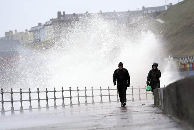
- There is a small chance that injuries could occur from large waves and beach material being thrown onto sea fronts, coastal roads and properties
Power update
Northern Powergrid said 1,000 properties still had no lights on Thursday morning due to the weather.
“Our teams have restored power to some 19,000 homes and businesses impacted by Storm Dudley, and we are working to get the lights back on for around 1,000 properties still affected,” a spokesperson said.
On Wednesday evening at 9pm, around 4,000 people were thought to still be without power. About 14,000 customers were originally affected by the weather but 10,000 had been reconnected.
Comment Guidelines
National World encourages reader discussion on our stories. User feedback, insights and back-and-forth exchanges add a rich layer of context to reporting. Please review our Community Guidelines before commenting.