Memories of 2013 tidal surge that caused worst flooding in Yorkshire since 1950s as 10th anniversary of event is marked

Both Hull City Council and Humberside Fire and Rescue Service have commemorated the floods a decade on, as the city was particularly badly affected and its defences only just prevented catastrophe.
The 2013 surge was the worst since the devastating North Sea flood of 1953, which caused thousands of deaths in Britain, the Netherlands and aboard vessels.
Advertisement
Hide AdAdvertisement
Hide AdIn Hull, 250 houses and several roads were submerged, and since then £42million has been invested in tidal defences. The Hull barrier, installed in 1980, was credited with saving the city from a 19ft tide during Storm Xaver.

More ‘frontage’ defences have since been added to protect properties around the docks and Marina areas, such as at Victoria Dock Village.
During the storm, there were gusts of 90mph and the fire service in Humberside received 300 emergency calls. Spurn Point in the Humber Estuary was breached, the surge cutting it off from the mainland and turning it into an island after the nature reserve had been closed.
In Hull, Victoria Dock was evacuated as water threatened to breach the sea walls – it eventually came within just 40cm of overtopping the defences. There was flooding in Albert Dock which spilled onto city centre streets. A Chiquitos restaurant was ‘swamped’.
Advertisement
Hide AdAdvertisement
Hide AdA group of contractors staying at the Inkerman Tavern pub were stunned to see their vehicles floating away on the ‘tidal wave’ and had to take refuge upstairs.
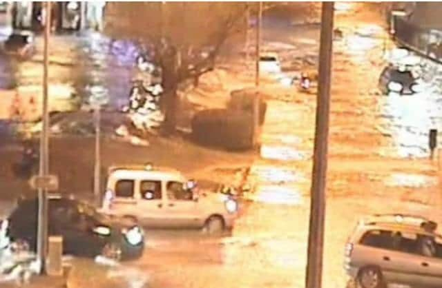
Further north, the Tees Estuary flooded Port Clarence, causing a mass power blackout. Whitby also saw extremely high tides, and an electricity substation exploded.
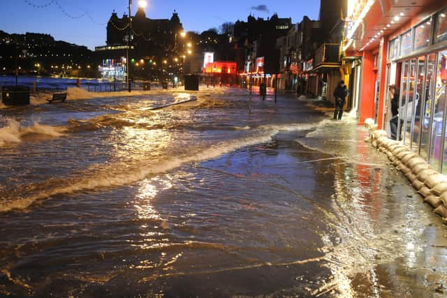
Two hundred homes there were flooded, some in the historic Church Street, and Scarborough and Bridlington also suffered, the latter seeing several cafes and restaurants near the harbour inundated. Holderness coastal villages such as Paull, Skipsea and Ulrome were battered.
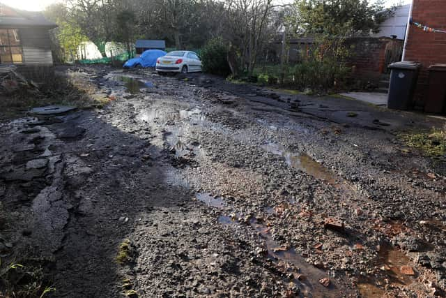
South Ferriby was particularly badly affected, with the entire lower village flooded and waters reaching seven miles inland and ripping a radiator from a wall.
Advertisement
Hide AdAdvertisement
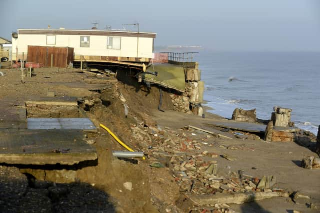
Hide AdThere was also damage to sea walls at Scarborough and a section of coastal defences in the Welwick area of Holderness. Static caravans were condemned after the waves tore off sections of the cliffs.
However, it was thought that the damage could have been worse if wind speeds had been even higher. The tides were actually higher than during the 1953 surge, but flood defences were more advanced. In the 1950s much protection came from sandbags.
Hull City Council’s flood management lead Coun Jack Haines said: “The council is committed to doing all it can to tackle flooding and the impact it has on local people.
"The 2013 flooding was unprecedented and had a lasting impact on Hull and its people. Now, it’s the council’s duty to do all it can to protect residents.
Advertisement
Hide AdAdvertisement
Hide Ad"An incredible amount of work has gone into preventing a disaster like this from happening again and the council will continue to ensure that the citizens and visitors of Hull have improved resilience against tidal flooding."
The council works with other local authorities in the Humber catchment to plan for flood management over the next 100 years.
The anniversary comes as parts of the UK are at risk of flooding with more heavy rain set to fall this week, forecasters say. Over three inches (80mm) of rain could lash parts of south-west England on Thursday, where a number of flood warnings are already in place.
The Met Office has issued a yellow rain warning covering the morning and early afternoon, saying people should expect travel disruption. It said: “Check if your property could be at risk of flooding. If so, consider preparing a flood plan and an emergency flood kit.”
Advertisement
Hide AdAdvertisement
Hide AdThe forecaster also issued warnings for Northern Ireland on Wednesday and further yellow alerts in parts of south-west and eastern Scotland and large swathes of Wales on Thursday. Flooding is possible in the worst affected regions and some could face power cuts, it said.
The Environment Agency had 49 flood warnings – where flooding is expected – in place across England on Tuesday morning, mainly in Dorset, Somerset and across the Midlands.
There were a further 174 flood alerts, where flooding is considered possible.
Meanwhile, temperatures across the country are expected to drop below freezing quite widely overnight and into Wednesday ahead of a milder rest of the week.
Comment Guidelines
National World encourages reader discussion on our stories. User feedback, insights and back-and-forth exchanges add a rich layer of context to reporting. Please review our Community Guidelines before commenting.