Storm Gerrit: New flood warnings in place for Yorkshire as 'supercell storm' batters region

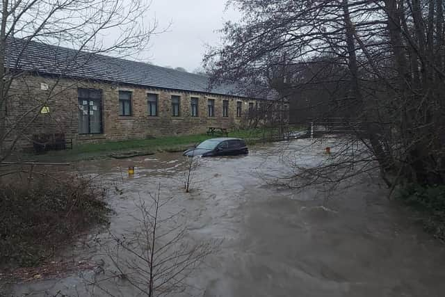
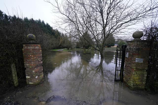
Over 30 flood warnings and alerts are now in place across Yorkshire as Storm Gerrit continues to cause chaos across the whole region.
The Met Office issued a yellow weather or rain in Yorkshire, covering 3am to 6pm yesterday (Dec 27), with the biggest risk being flooding.
Advertisement
Hide AdAdvertisement
Hide AdHeavy rain caused river levels to rise and roads were subsequently flooded – with several being closed, including the A1 northbound between J52 and J53. Several trains were also cancelled yesterday (Dec 27).
The storm battered the region with reports of a tornado in Greater Manchester and Yorkshire overnight and residents took to social media in shock at the weather.
One said: “The loudest & longest thunderclap that I’ve ever heard at 2.07am in Dent. Must have been this.”
Another added: “Woke me up in Lupton, thought our barn had collapsed.”
Advertisement
Hide AdAdvertisement
Hide AdThe Met Office confirmed that a “supercell thunderstorm” crossed parts of the UK, waking residents up in the middle of the night and causing power outages.

The Met Office said: “Last night a supercell thunderstorm crossed Greater Manchester causing damage. We know from our Dopplar radar that it had a strong rotating updraft.
"Whilst we don't yet have surface data to confirm, the presence of these features suggests a tornado at the surface was likely.”
According to the National Weather Service, Supercells are the least common type of thunderstorm, but they have a high propensity to produce severe weather, including damaging winds, very large hail, and sometimes weak to violent tornadoes.
Advertisement
Hide AdAdvertisement
Hide AdThis morning (Dec 28), Kirklees Council reported that Rowley Lane, Lepton, was closed due to a fallen tree, while the council worked to move it.
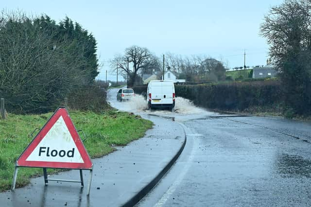
Yesterday (Dec 27), West Yorkshire Fire and Rescue Service also warned travellers not to drive through any floodwater that’s moving or more than 10cm (4 inches) deep after Rastrick Fire Station officers were called out to rescue a member of the public stranded in their car.
Now there are currently nine flood warnings and 28 flood alerts across the region including:
- River levels in the Upper River Hull catchment remain high due to recent rainfall and elevated groundwater levels associated with Storm Gerritt. Areas most at risk include the River Hull and tributaries at Frodingham, Hempholme, Wilfholme and Burshill.
- Flood warnings concerning the North Sea at Scarborough, Foreshore Road and Sandside. Areas most at risk include properties on Foreshore Road from the roundabout to West Pier and properties on Sandside and those around the Old Harbour with wave overtopping and spray likely to cause some localised flooding.
- River levels are rising on the River Ouse due to Storm Gerrit. Flooding is expected at Naburn Lock Buildings and Lock Cottages, with further rainfall is forecast over the next few days.
- River levels are rising on the River Ouse due to heavy rainfall. Flooding is expected on King's Staith in York and riverside areas through York from Lendall Bridge to Millennium Bridge.
- Properties along Queen's Staith, on South Esplanade, Friars Terrace and Tower Place. St George's Field carpark and Rowntree Park, due to rising river levels on the River Ouse.
- Rising river levels on the River Swale Howe Village and Skipton Bridge including properties along and off the B6267 and the A61.
- River levels are rising on the River Tutt at Boroughbridge due to heavy rainfall.
- River levels are rising at Westwick Weir and Boroughbridge Camping and Caravanning site as a result of rainfall associated with Storm Gerritt.
There are also flood alerts at:
- Burstwick and Keyingham Drains
- Gypsey Race and the Wolds
- Lower Dunsforth Access
- Lower River Aire catchment
- Lower River Ancholme
- Lower River Derwent
- Lower River Lune and Conder
- Lower River Nidd catchment
- Lower River Swale
- Lower River Tees and estuarine tributaries
- Lower River Ure
- Lower River Wharfe
- Middle River Nidd catchment
- River Calder in east Lancashire
- River Rye catchment
- River Seven catchment
- River Wiske and other tributaries of the River Swale
- Upper River Aire catchment
- Upper River Derwent
- Upper River Eden
- Upper River Hull catchment
- Upper River Lune
- Upper River Nidd catchment
- Upper River Ouse
- Upper River Ribble, Hodder
- Upper River Tees
- Upper River Wharfe
- Upper River Wyre, Brock
All these areas have flood warnings and the government is urging people to “act now” saying people should:
- move vehicles to higher ground if it’s safe to do so
- move family and pets to safety
- move important items upstairs or to a safe place in your property, starting with cherished items and valuables, then furniture and furnishings
- turn off gas, electricity and water supplies if it’s safe to do so; never touch an electrical switch if you’re standing in water
- if you have property protection products such as flood barriers, or air brick covers, use them now
- keep track of the latest flood risk situation
Comment Guidelines
National World encourages reader discussion on our stories. User feedback, insights and back-and-forth exchanges add a rich layer of context to reporting. Please review our Community Guidelines before commenting.