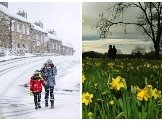
White Easter? Yorkshire facing up to another icy blast but will we see more snow this weekend?


Revealed: Ten of the most expensive properties for sale in Leeds todayForecasters say a mixture of Arctic weather and an unsettled sweep of low pressure from the Atlantic will hit Britain this week, leaving the country gripped in a cycle of wet, windy and wintry conditions.
While the south of Britain can expect plenty of rain and wind from the middle of this week, the north will experience somewhat bleaker weather with a chilly Scandinavian edge adding to the already unsettled outlook.
Advertisement
Hide AdAdvertisement
Hide AdYorkshire has been hit by two significant icy blasts in 2018 with the Beast from the East causing traffic and travel chaos across the whole county. A third Siberian blast had been expected, but that now seems unlikely... although there could still be some snow on higher ground and sleet showers elsewhere.
The Met Office has warned that temperatures will struggle to hit double figures from Wednesday onwards but it won't be as cold as it was earlier in March.
The 15 actors you didn’t know come from LeedsIt states that Yorkshire will be "turning colder Wednesday and Thursday with sunshine and scattered showers, perhaps wintry at times over hills". And that there will be "some hill snow on Friday" as we head into Easter weekend.
Why has it been so cold in Britain this winter?
The freezing conditions were triggered when two meteorological events combined in February that would eventually trigger freezing temperatures and snow blizzards across the country.
Advertisement
Hide AdAdvertisement
Hide AdA Sudden stratospheric warming (SSW) and a polar vortex split above the Arctic disturbed the jet-stream so much that it caused it to head further south than usual. The high pressure that built over Scandinavia in turn started to drive colder air and freezing conditions toward Britain, resulting in two Beast from the East storms.
Weather forecasters have predicted that the effects of such an icy cocktail of events could linger for about 60 days, and that could mean colder than normal temperatures being felt right through to the end of April.
So will we get a white Easter and when will it start to warm up?
With two icy blasts from the east already having hit Yorkshire, there have been some suggestions that a third white-out could be on its way over the Easter holiday period.
Advertisement
Hide AdAdvertisement
Hide AdWhile experts remain guarded over the extent of any 'White Easter', The Weather Channel reports that computer models are still pointing to a cold and unsettled period over the coming weekend, while the Met Office predictions are for temperatures to remain in single figures.
The personal information Facebook collects that you might not know aboutThe Weather Channel website states: "High pressure to the west of Britain and low pressure in the east could push cold Arctic air down across the county on a brisk northerly breeze during the four day-long weekend. According to the latest data, temperatures could fall up to -3 to -6C below normal for the time of year over Easter.
"But significant wind chill will make temperatures feel even colder than this due to the icy northerly flow."
Forecaster Sarah Sammy, of The Weather Channel, said the most intense cold will take place on Wednesday and Thursday.
Advertisement
Hide AdAdvertisement
Hide AdOvernight minimums could touch freezing, while daytime "temperatures over north-west Europe drop up to -4 to -8C below normal for this time of year." she added.
However, she added that temperatures will generally be above freezing in the day, "so it is more likely that sleet will be experienced at lower levels across the British Isles rather than snow."
Dr Todd Crawford, chief meteorologist at The Weather Channel, says there could yet be one more big cold snap from the east before May as 'dry and cold conditions take charge under high pressure throughout much of April'.
He said: “As we head into April, most computer forecast models suggest we will get at least one more big cold spell before the blocking pattern fades, with warmer and wetter weather confined to parts of southern Europe.
"For May, we are forecasting above normal temperatures for the UK to western Scandinavia."