UK weather: Country braced for snow and flooding this week despite mild November temperatures
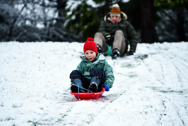
Snow could hit parts of the UK as early as this week according to forecasters, as November’s mild temperatures come to an end. Scotland and northern England along with areas of Wales could all see flurries of the white stuff in the coming days.
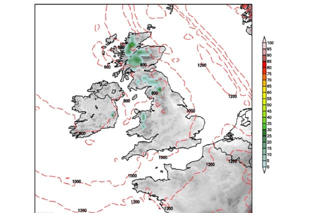
Snow Risk Maps from Netweather show snow arriving in the Scottish Highlands from midday on Tuesday, creeping into Cumberland, Northumberland, Westmorland, Durham, Yorkshire and Wales by Friday afternoon.
Advertisement
Hide AdAdvertisement
Hide AdThe weather experts’ interactive maps are generated from Global Forecast System (GFS) data, showing where precipitation is most likely to hit. Updated four times a day, it also includes an experimental snow depth gauge to give you an idea of how much is likely to settle, giving you advanced warning of any likely disruption.
However, the Met Office is predicting largely settled weather for most of the country in the next seven days. Over the weekend they are forecasting rain in the north with brighter conditions in the south.
The national weather service also warns of isolated fog patches with fog and low cloud persisting in the northeast until Sunday. Temperatures are likely to be very mild for most though.


Heading into the start of next week, be prepared for weather to turn more unsettled with spells of wet and windy weather for all areas at times through the week and temperatures returning back to nearer average. Looking further ahead to the rest of the week, a Met Office spokesperson said: "On Wednesday, clear spells and showers for many, locally heavy with the risk of thunderstorms. A band of heavy rain will affect the southwest later, accompanied by strong winds and coastal gales, spreading across all parts overnight.
Advertisement
Hide AdAdvertisement
Hide Ad“For the end of the week, unsettled conditions are likely to continue with outbreaks of rain or showers. The wettest conditions are expected in the west, with strong winds and the potential for severe gales.
"Continuing through the rest of the period, further spells of rain interspersed with brighter spells are likely, with gales possible. Driest conditions are likely towards the east. Towards the end of the period, high pressure may become increasingly influential, likely bringing longer spells of dry and settled weather, with lighter winds. Temperatures are likely to remain around normal."


UK flood warnings
Before the snow arrives, the Environment Agency has also issued a flood warning for this weekend. The alert is for the Upper River Derwent, Stonethwaite Beck and Derwent Water Lake.
Levels are predicted to remain high over the next couple of days but continue to slowly fall at Derwentwater. Areas most at risk include low lying areas bordering the shores of Derwentwater and Keswick Camping and Caravan Club Site.
An Environment Agency spokesperson said: "Continue to avoid using low lying footpaths and any bridges near local watercourses and do not attempt to walk or drive through flood water."
Comment Guidelines
National World encourages reader discussion on our stories. User feedback, insights and back-and-forth exchanges add a rich layer of context to reporting. Please review our Community Guidelines before commenting.
