Weekend Walk: Addingham Circular


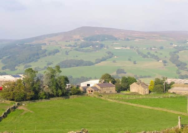
This route explores the peaceful paths and tracks to the south, including an excellent green road known as Parson’s Lane. Further good tracks are visited on the shoulder of Rombalds Moor before the descent back into Wharfedale. At Cringles you can see an old survey tower built while constructing the Barden aqueduct which brings Nidderdale water to Bradford. Near the end of the walk look at a blue plaque on Southfield Terrace, which poignantly records that of 30 men who left these houses for the Great War seven didn’t return. Look for goldfinches on Rombalds Moor, common buzzards over farmland.
1. Walk west on the main street, turn left at a tile showroom, go through the car park. Through a gate turn left up steps and go right at the top to walk behind houses. Continue over a road into woodland, cross a footbridge and turn right over stepping stones. Continue up the bank, bearing right to follow the path. Cross a road with care, turn left and angle to the top right corner of playing fields, then turn right on a street. At the end take a cul-de-sac on the left to cross the A65 with care.
Advertisement
Hide AdAdvertisement
Hide Ad2. Through a gate go left to follow a minor road. Turn right onto a track, Parson’s Lane, signposted to Oak Tree Farm. It becomes a wide green road and eventually emerges on a quiet back road. Turn left and quickly right onto Cringles Lane and walk downhill.
3. Before a farm access road go through a low wall gap and follow a path down to a gate. Follow the farm road into a dip, go left over a footbridge, climb up the bank beside a stream and continue into the next field walking with a hedge on the right. Follow the path to Foster Cliffe Farms, looking for Millennium Way signs. Before the farmhouse turn right over a bridge.
4. Over a stile, turn left and follow the track past a farm. Through a gate bear left across a field to another gate. Walk with trees on the left until a line of trees, then turn downhill to a bridge over Great Gill Beck. Turn right and walk round an eroded bank to climb to the top and follow the path along a line of fence posts. Over a track turn left to cross two ladder stiles. At a third go through a garden to reach the A6034.
5. The public footpath on the other side has been diverted. Turn left and walk along the road past the survey tower and cross with care to an access road. In front of house gates turn left to a stile. Walk through a field to a gate and continue ahead uphill to a wall gap. On the other side cut through trees to join a track. Keep right at a fork and turn right on Lippersley Lane. Past Sea Moor Farm turn left to walk down tarmac Cocking Lane.
Advertisement
Hide AdAdvertisement
Hide Ad6. Turn left on a track to Gildersber. Swing left before the farmyard and look for a path going right, through a gate and garden. The path emerges behind the farmyard, and turn left to follow a gated track down past farm buildings. Continue this course when the track goes right and follow the path to cross the Addingham bypass with great care. On the other side continue ahead. Follow the path right to emerge at Southfield Terrace. Walk down to Old Station Way and turn left to reach the main street.
Difficulty rating: 3 stars.
Distance: 7 1/2 miles
Time: 3 1/2 hours.
Map: OS Explorer OL21 (1:25000) South Pennines
Parking: Addingham village.
Public transport: Addingham is on the X84 Leeds-Skipton and 762 Ilkley-Keighley bus routes. Ilkley is on the Wharfedale rail line and Keighley is on the Airedale rail line. For all times visit www.traveline.info or call 0871 2002233 (charges apply).
Refreshments: Addingham
Toilets: For refreshments customers.