Weekend Walk: Baildon Moor


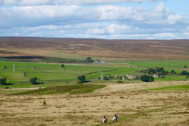
It begins on the very edge of the built-up area, and within a few minutes walkers are following a moorland path and heading for one of the best viewpoints in West Yorkshire. From the flat top of Baildon Hill (920ft high), in clear weather it is possible to see Emley Moor Mast and the edge of the Peak District to the south, the Bronte Moors and Forest of Bowland to the west, the long line of Rombalds Moor to the north, and across the Vale of York to the east. Baildon Moor is now mostly rough grazing, but coal was mined on Baildon Hill until 1863. Birds to look out for include skylark, red kite, and winter visitors like redwings and fieldfares.
1. From Baildon centre walk northwards, passing The Malt Shovel on the right. Before a cattle grid go left on a signposted footpath into Baildon Golf Club car park and follow the path to the right side of a building then left to follow an obvious course along the edge of the moor and golf course. Go left at a fork and ignore other turnings to keep a straight course to the trig point on Baildon Hill.
Advertisement
Hide AdAdvertisement
Hide Ad2. From the trig point keep the same straight course as before, descending the other side of Baildon Hill with the village of Eldwick ahead. Aim towards the right corner of a caravan park. Just before it branch right on a bridleway. It becomes difficult to follow through bracken so aim for the road junction seen below. When a road is met turn right to reach the junction.
3. Cross the road, Glovershaw Lane, with care and turn left. Almost immediately pass through a handgate on the right and follow a path along the edge of Baildon Moor. Eventually, go through a metal gate and cross a gallop to walk beside another gallop, which curves right. Turn right at a track with a Dales High Way waymarker and continue to Birch Close.
4. Go through the gate and pass Birch Close. Follow the track to more buildings, and at a juntion go right to pass Faweather Grange and follow the track known as Sconce Lane. On a bend look for a wall gap on the right and pass into the grounds of a children’s camp. Take a path running between wall and fence. Emerging on the moor, turn left to follow an obvious path to a car parking area.
5. Cross Hawksworth Road with care, go right for a short distance to take a signposted path above The Whitehouse. On meeting an access road turn left then go right to find steps leading to a path which runs to the side of Baildon Rugby and Cricket Club. Beyond it continue ahead on Heygate Lane, and at a mini-roundabout turn right into Hallcliffe, which leads back to the centre of Baildon.
Difficulty rating: 2 stars.
Distance: 4.5 miles
Time: 2 hours.
Advertisement
Hide AdAdvertisement
Hide AdMap: OS Explorer sheet 288 (1:25000) Bradford and Huddersfield.
Public transport: Baildon is on bus routes from Bradford, Brighouse and Otley. Baildon station (15 min walk from route) is on the Wharfedale Line. For times visit www.wymetro.com or call 0113 245 7676.
Parking: Baildon pay & display or responsible street parking.
Refreshments & Toilets: Baildon