
Keld, Swaledale: The Yorkshire village which counts Yorkshire Shepherdess Amanda Owen among its local residents
"Keld is the last and the highest village in Swaledale, a goal to be reached from the valley, a haven to come down to from the hills. There are farms and hamlets beyond it, but the real life of the Dale stops there. It is a metropolis for the head of the Dale.”

While Yorkshire Dales social historian Ella Pontefract’s 1934 description of Keld as a metropolis could be misleading to those unfamiliar with the national park, it does underline the village’s remoteness and importance for its expansive hinterland.
Keld, near the head of Swaledale, is framed by the high ground of Black Hill and Clumpstone Hill to the south west and Kisdon to the south east, and valley sides which exceed 600 metres in places.
Earlier this year fourth-generation sheep farmers Claire and Andrew Calvert, whose farm is near the village, spoke about how the community dealt with extreme winter weather, says after seeing temperatures plunge to -12 and battling through 2.5ft snowdrifts.
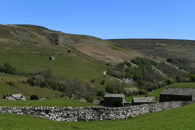

The surrounding vast moorlands, which often become impassable in winter, must be crossed to reach the nearest towns of Kirby Stephen and Hawes, meaning residents often look towards Richmond, some 21 miles distant.
Local resident Yorkshire Shepherdess Amanda Owen has told how some of her children were born in lay-bys as she made her way towards the then nearest maternity hospital, 40 miles away in Northallerton.
So the approach to Keld along a gently rising lane lined by dry stone walls does nothing to lessen the impression when arriving in the village that you are completely off the beaten track.
However, being at the crossroads of two of the country’s most popular long distance trails, the path to Keld is well beaten.
The village sits where the Pennine Way and Alfred Wainwright’s Coast to Coast path intersect and is also a destination for single day walkers, whether wanting to challenge themselves on extremely rugged topography or view the lush meadows between Keld and Muker.
The village has long been a popular destination. In the 1890s the Cooperative Holiday Association brought families from Lancashire to camp in Keld.
In addition, Keld has for many decades been a magnet for those wanting to see or even swim in the nearby waterfalls and pools. Wain Wath Force, half a mile upstream from Keld is regarded as one of the best places to wild swim in the Yorkshire Dales, while there is also East Gill Force, just east of the village, Catrake Force, which can be accessed through the village campsite, featuring a series of four steps, each its own small waterfall.
Perhaps the best known waterfalls at Keld is Kisdon Force in a wooded gorge dominated by ash, with wych elm, rowan and, locally, downy birch. Many typical woodland herbs make up the ground flora including dog’s mercury, false brome, primrose and wood sorrel.
It’s a beauty spot popular with photographers, but it is not without its danger. Last September a man fell 15 feet while trying to photograph the cascading water, leading to a rescue involving Swaledale Mountain Rescue Team, Yorkshire Ambulance Service, the Coastguard helicopter, RAF Leeming Mountain Rescue Team and the Great North Air Ambulance Service.
The narrowness of the dale around Keld has restricted opportunities for the growth of crops or hay making, leading farmers in the area to pastoral husbandry.
The name Keld is of Old Norse derivation, leading to a theory the settlement may have been a summer settlement for shepherds before the Norman invasion. An early reference to Keld relates to a mid-13th century cattle farm owned by the monks of Rievaulx Abbey, near Helmsley.
Meadows to the west of the village are thought to have once been part of a medieval park providing winter grazing.
Later the farm became a tenancy before being repeatedly divided due to the local custom of partible inheritance, a system where property or land is divided and shared among all heirs.
Historians have found all the tenants in Keld in the 16th century bore the surname Alderson.
In 1560 Ralph Alderson of nearby West Stonedale bequeathed a shilling for the priest of Keld and a survey three years later found there were 40 families living in Keld chapelry.
The chapel-of-ease closed following the upgrading of Muker chapel, before a nonconformist chapel was built on the site in 1791 before being replaced a United Reform Church in 1860, which continues to form one of the Keld’s most prominent buildings.
The nonconformist movement was significant in Keld due to its a strong following lead miners, an industry that saw the population of the area surrounding the village swell to around 700 in the 1840s.
The Keldside mines which were opened by the Company of Mine Adventurers of England in the 1740s and it is thought a number of the cottages in Keld were built to accommodate miners. Neverthelss the village itself remained small as most miners chose to live near the mines, some of which were about two miles from the village near the point at which Sleddale merged with Birkdale.
The mines suffered from flooding issues before they were abandoned in the Victorian era and by the turn of the century Keld’s population had fallen to 300. Now it stands at about 100.
A small chapel school was built outside the place of worship in 1842, and in 1861 a Literary Institute, and close by in the 1920s a public hall and reading room. The reading room forms the south side of a small square beside the main road and represents the last public building of significance to be built in the village. The school closed in the 1970s. Some of the buildings now form a heritage centre and free-entry museum telling the story of hill farming, mining and wildlife conservation in Upper Swaledale.