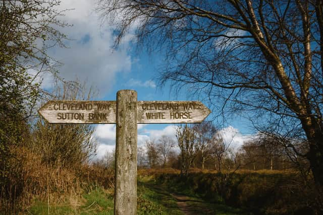
Thousands of "lost pathways" in North Yorkshire are under threat of being lost forever project by the Ramblers has uncovered
The Don’t Lose Your Way project launched by the Ramblers earlier this year was a rallying cry to find the missing routes before the 2026 closure of the Definitive Map.
The paths, which people have often used for centuries, must be recorded on the official map before January 1, 2026 or risk being lost forever.
Advertisement
Hide AdAdvertisement
Hide AdThe project saw volunteers search 154,000 one-kilometre squares of England and Wales using an online mapping tool to uncover lost rights of way which were left off the council maps drawn up in the 1950s.

Thousands of people took part and by comparing historic maps with current official records, they helped discover 49,138 miles of missing paths. Nearly five times more than the Ramblers original estimate.
Project manager, Jack Cornish said: “The amazing response we had from the public to help us search for missing rights of way just goes to show what an important place our path network holds in the hearts of so many of us.”
Mr Cornish said many could make useful additions to the existing network of footpaths, creating new circular walks or making it easier for people to access local green spaces and countryside, something which has become increasingly important during the coronavirus pandemic.
Advertisement
Hide AdAdvertisement
Hide AdSome of the “lost” paths are still in use, despite not showing up on modern maps, while others have become overgrown and unusable. It is not just rural rights of way which are affected, urban alleyways and shortcuts will also be lost if not recorded.
But, the charity warned, if these paths are not claimed by the Government set deadline, it will no longer be possible to add them to the maps and the public’s right to access them will not be protected in the future.
The project found Yorkshire and the Humber had 4,524 miles of un-registerd pathways with more than half, 2,651, in North Yorkshire.
The county with the highest number of paths was Devon with 2,949 miles, followed by North Yorkshire and then Hereford with 2,253 miles.
Advertisement
Hide AdAdvertisement
Hide Ad“By getting the most useful of these paths back on the map, we will not only be saving a little bit of our history, we’ll also be able to improve the existing network, creating new and better walking routes, enabling more of us to more easily enjoy the outdoors,” Mr Cornish said.
The Ramblers is asking the public to help save lost paths with a crowdfunder which has been kickstarted by Cotswold Outdoor with £10,000
The charity is also calling on the Government to extend the deadline for registering rights of way by five years.
People can find out about lost paths in their area, how to join in the efforts to get them on the map and make a donation at the Ramblers’ website: ramblers.org.uk/DLYW
Advertisement
Hide AdAdvertisement
Hide AdSupport The Yorkshire Post and become a subscriber today. Your subscription will help us to continue to bring quality news to the people of Yorkshire. In return, you'll see fewer ads on site, get free access to our app and receive exclusive members-only offers. Click here to subscribe.Link to use: https://www.yorkshirepost.co.uk/subscriptions
Comment Guidelines
National World encourages reader discussion on our stories. User feedback, insights and back-and-forth exchanges add a rich layer of context to reporting. Please review our Community Guidelines before commenting.