
Wheldrake, near York: Shaped into a watery haven for wildlife
Despite some 11,000 years having past, Wheldrake’s place as the glacial maximum limit of the last Ice Age continues to shape its future.
Built on a terminal moraine, or a mound of debris deposited at the front of the glacier, the main thoroughfare of the village seven miles south-east of York runs along the top of the ridge of the geographical feature where it is cut through by the River Derwent.
The clay of the moraine is topped by a variable strip of sand and gravel, in places exceeding 50 feet above sea-level, meaning the fertility of the soil changes markedly, dictating the agricultural area’s produce.
While it is believed the village’s name relates to both the moraine and wells in the area, the glacial watershed is most apparent at the junction of Benjy Lane and Wheldrake Lane to the west of the village, where the land frequently floods after downpours and in winter.

Where the moraine meets the clays of the former glacial lakes, to the east of Wheldrake on Greengales Lane and Thorganby Road the land is prone to flooding and nearby is the site of a hamlet called Waterhouses, which was abandoned after the Black Death. Little evidence remains of the deserted settlement beside the river on the left of the single track lane to Yorkshire Wildlife Trust’s Wheldrake Ings nature reserve, which is part of a series of flood meadows in the Lower Derwent Valley.
While venues for open water swimming and fishing surrounding Wheldrake are popular draws, recent years have seen soaring numbers of visitors to the water meadows, which have been designated as a Special Area of Conservation and a Special Protection Area. Underlining its international importance as a wetland, the 157-hectare reserve is also featured on the Ramsar List, as well as being a Site of Special Scientific Interest and a National Nature Reserve. The haven attracts flocks of overwintering waders and wildfowl. Ornithologists say the best time of year to visit to see breeding waders such as whimbrel starts in a few weeks, while emerging plants will include marsh marigold, greater burnet and the rare narrow-leaved water-dropwort.
The beauty spot is the breeding ground for 60 per cent of the wild English corncrake population and is visited by up to 70 per cent of the UK’s waterfowl. Bird watchers have spotted more than 60 bird species at the reserve this month alone, including common merganser, eurasian bullfinch, eurasian oystercatcher and the peregrine falcon, the world’s fastest animal, while in 2023 breeding otters were spotted there for the first time in 60 years.
While the trust said the presence of a mother and her cubs was a sign of improving water quality, last March Natural England’s plans for a building at Bank Island, off Church Lane, featuring a wildlife watch tower, laboratory, meeting spaces and dormitories was approved.
The government body had claimed the reserve was as important for its grassland and breeding grounds for birds as York Minster and its Roman walls are to York’s heritage.
Wheldrake’s proportion of surviving heritage assets are considered significant for its size, with more than 20 listed properties in a conservation area focused on Main Street, which becomes Church Lane, as well as back lanes formed in medieval times, which run behind the garths to both the north and south. It is thought the regular “toft and croft” layout of the village stems from replanning in the Middle Ages or following William the Conqueror’s Harrying of the North.
The village’s older properties include 17th century farms with outbuildings such as dovecots, some striking Elizabethan properties with exposed timber frames as well as Jubilee Cottage, which features chimney pots with diamond shapes to herald the 60th year of Queen Victoria’s reign.
The late 18th century Half-Way House was supposedly named after becoming a spot for coffin-bearers to take a rest en route to the grade I listed Church of St Helen, where one curate in the 16th century was found to be distributing seditious and papist literature.
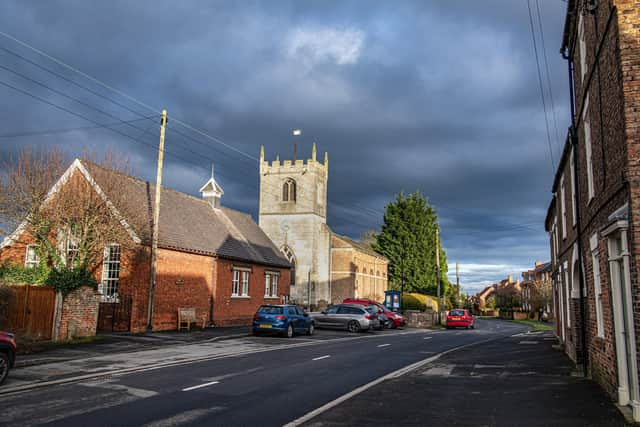
Although much of the church is effectively a large Georgian room, dating from when it was rebuilt in late 18th century, its tower is medieval and its font, which for 200 years served as a pump trough for a cottage on Main Street, is thought to be older still. Some 20th century features of the church include the pulpit and altar furnishings, which were fashioned by “Mousie” Thompson of Kilburn, while its broad spaces and lack of pillars are said to create good acoustics for concerts.
While housebuilders look set to increase the settlement by about a third, community leaders have argued Wheldrake has already outgrown its facilities, which include a convenience store, a 1970s village hall, the Wenlock Arms pub, an extensive area of allotments, a Church of England primary school on North Lane and a children’s nursery boasting 1.8 acres of outdoor space and a forest school.
More unusually, the heart of the village has a thriving Sicilian cafe, offering cannoli. Beside the cafe is the base for IW Myers funeral directors, which is reputed to be the oldest established family funeral directors in Britain, having been founded in 1701.
Modern housing is built on what once was the site of the village railway station, which closed for passengers in 1926, just 14 years after opening on the Derwent Valley Light Railway, also known as the Blackberry Line for its special services for bramble pickers from York.
The station survived the Beeching cuts and in a noteworthy drive to conserve it, was disassembled brick by brick by volunteers, and rebuilt it at the Yorkshire Museum of Farming at Murton.
The first homes of the latest estate, Bramble Wood, are set to go on sale in the coming months, with green credentials including boxes for bats and swifts, sparrow terraces, a hedgehog highway, 100 newly planted trees, and some 280 metres of hedgerow.
dsdasdasd