
Bridestones Moor: Hidden past of Yorkshire moors to be revealed with drone

It’s a far cry from Time Team days when archaeologists had no choice but to drag ground sensing equipment across rough ground to find out what lies beneath.
Now a powerful new drone is helping students unravel what lies beneath Bridestones Moor near Todmorden.
The M400 drone has been recently acquired by the University of Bradford, thanks to Arts and Humanities Research Council funding.
On its maiden flight it had a piece of equipment known as LiDAR attached to it. This uses rapid laser pulses to measure distances and build precise, three-dimensional maps of environments.
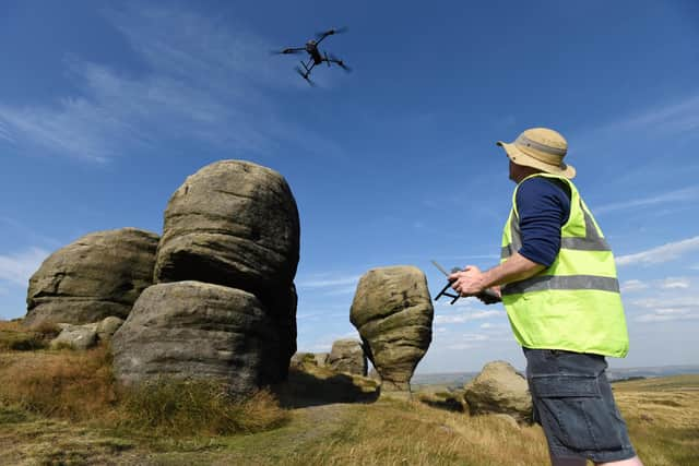

“Basically it is going to allow us to see the shape of the landscape, without the moor grass and heather,” said Dr Jodie Lewis, Associate Professor in Archaeology at the University of Bradford.
During the Mesolithic period, around 8,000 years ago, nomadic hunter-gatherer communities are believed to have hunted deer and large mammals on the high moors.
Flint blades, cores, chippings, flakes, and small microliths left at temporary upland camps used to be picked up off the moors in the 1960s and 1970s when "flinting” was a popular amateur hobby.
The 114-acre moor was recently bought by a community interest company called Bridestones Rewilded, which wants to transform it into a thriving nature reserve.
"We wanted to investigate to see if we could find any of those find spots to see if they were associated with any hunter gatherer encampment or settlement,” said Dr Lewis.
Elsewhere in the Pennines people have discovered fire pits and post holes suggesting the hunter gatherers might have had wind breaks and tents.
They were probably places they were returning to seasonally, said Dr Lewis.
"We are going to use drone-based geophysics, so if there are any fire pits up there we should be able to see them beneath the peat, bearing in mind in some places it is 2m deep, in others 1m or 20cm.”
A dig during the two-week field project, which ended last week, uncovered a flint, possibly a waste flake.
"The fact we found any flints was a bonus because the excavation was much more about establishing the peat depth,” added Dr Lewis.
"We’ve started with the LiDAR survey to look at the shape of the landscape. Once we have that information we can do a model.
"We can do wider drone based surveys, using ground penetrating radar and magnet to map features below the ground. LiDAR shows us any archaeological structures on the surface hidden by vegetation.
"Geophysics show us things below the ground.
"And we can do that all with the drone. It is amazing. It means we can capture data literally without disturbing anything on the ground.”