
Hoylandswaine: The Yorkshire village with a proud heritage built on making nails
"Hoylandswaine nailers go rat-a-tat tat, On thin watter porridge, and no' much o' that."

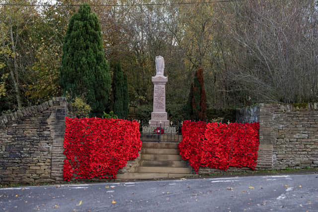
So opens a 19th-century folk rhyme that illustrates the tough life of residents in what has become a South Yorkshire commuter village known for its spectacular displays of locally crafted poppies in November, mid-way between Penistone and Silkstone.
Despite the winds of change having buffeted and shaped the elevated village, fascinating traces of its varied industrial past remain.
Sited on an old salt track used to transport the condiment from Cheshire to Barnsley, the village is landmarked on the A628, which has bypassed Hoylandswaine for approaching a century, near its Barnsley Road entrance by a row of purpose-built linen weavers’ cottages.
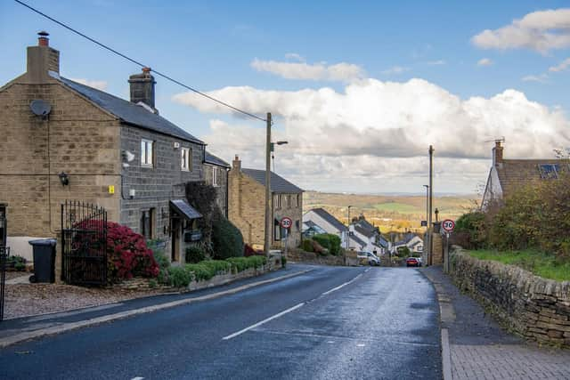

The trade, recorded in Hoylandswaine as far back as the reign of Charles I, made full use of the damp upland air to weave locally-grown hemp into linen cloth in the properties’ windowed basements before being transported six miles to Barnsley for bleaching.
The village’s main gateway is also overlooked by The Lord Nelson pub, which is open six days a week and serves hearty meals, some with an American twist such as sweet waffle burgers, alongside traditional Yorkshire fare, including meat and potato pies.
There are panoramic vistas across the valley from outside the historic inn.
Hoylandswaine’s name is a mix of Old English and Norse for a cultivated site atop a ridge belonging to Swein, and it is its elevation between 106 metres and 276 metres above sea level that is the first noteworthy feature for visitors.
The upland village boasts a range of far-reaching views, particularly towards the east and northwards, from Highfields and Greenside, across fields and community open space towards towards the Cawthorne Dike valley and Deffer Wood.
Opposite the pub, on a paved recess alongside a bench, stands a yet older watering hole in the form of a stone trough.
Pupils at the village’s school, on Haigh Lane, which last year saw its children achieve reading and writing standards above national targets, have followed a tradition of decorating the feature with murals for the village festival, reflecting the custom in nearby Derbyshire of giving thanks for water.
Last month the school was commended for being at the heart of the village, ensuring each of its 90 pupils feels like they belong there and for fostering strong links with the families and the community.
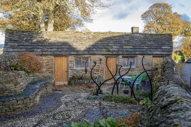
As well as well dressing, Swainefest in July celebrates the village’s heritage with tours of South Yorkshire Industrial History Society’s nail forge, a garage-sized sandstone property with stone slate roof in a cottage garden on the north side of Barnsley Road.
Once part of a group of buildings known as Mustard Hill which have been transformed into large homes, remarkably the diminutive building once housed three nailshops with their own forges.
It is the country’s sole surviving nailshop with its original bellows, a cracked hearth where iron rods were heated until they were red-hot before being fashioned into brad, horsenail, rose, clout and ornamental sparrable nails.
While another former nailshop remains on Cooper Lane, to the village’s north, the building has been repurposed as a garage.
Evidence of the 90-odd other nailmakers in Hoylandswaine in the mid-19th century, making the most of ironstone mined just to the west of the village, has been erased since the industry finally disappeared from the village in the 1940s.
Behind the Barnsley Road nailshops stands the village’s only green spaces, Hoylandswaine’s cricket and bowling clubs.
The latter club fields eight teams in two leagues, while the former’s small pitch hosted a girls cricket festival this summer.
Nevertheless, critics have accused the cricket club of buying in talent rather than developing players.
Recent months have seen its latest star, former England all-rounder Samit Patel, help them win the Premier Division, the Sykes Cup and the delayed 2025 Yorkshire Champions’ Trophy.
The area also features Hoylandswaine Village Hall, which dates from nine years after the aforementioned admiral was killed at the Battle of Trafalgar.
The building uses local Carboniferous Grenoside sandstone, which like many older buildings in the village has been blackened by historic industrial pollution.
Built as a Sunday School it has served as a community hub since the 1980s.
The village’s mid-Victorian church and hall on Haigh Lane, also plays a key community role, hosting friendship and lunch clubs alongside twice monthly services. Almost opposite the former nailshops on Barnsley Road, is Skinpit Lane, named after the tank used to soak animal hides during the tanning process, on the site of an abattoir for four decades from the 1930s.
Villagers collected bark from the numerous nearby woodlands and crushed it to release tannins to toughen and preserve the animal skins.
Other historic industries in the village included coal mining, due to being on the western edge of the South Yorkshire Coalfield, with one seam coming close to the surface near Cooper Lane.
A remnant of Primrose Mine, at Guyder Bottom, which produced 12,000 tons of coal in its heyday and closed in 1969, in the form of a large flat stone can be seen, which served as a platform to load drays.
Originally a linear settlement, housing developments have seen Hoylandswaine morph into a rectangular shape.
Most properties within its core are residential, but evidence of Hoylandswaine’s original industry – agriculture – remains.
To the north of the cricket ground, there’s the 17th century Nook Farmhouse, which was built using thinly-coursed rubble and to the north of Haigh Lane, beside Pinfold Farmhouse, there’s a 16th century timber-framed agricultural building constructed around curved, natural timber blades.