
Trent Falls: The dangerous Yorkshire 'falls' where there are no waterfalls
Despite the name there are no waterfalls at the point where the River Ouse meets the River Trent to flow eastwards as the mighty Humber estuary.
On the west and north sides of the confluence is the East Riding of Yorkshire. To the east and along the south bank of the Humber lies Lincolnshire.
Together, the Ouse and Trent drain approximately one-fifth of England’s land area (9,500 square miles).
Each tide deposits 1,500 tonnes of muddy sediments from the North Sea, necessitating frequent dredging to permit cargo ships to reach Goole on the Ouse and Groveport, near Scunthorpe, on the Trent.
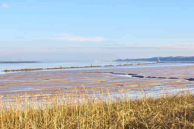

Despite the absence of waterfalls this short stretch of river is sometimes hazardous to shipping.
Being tidal, there is a notorious “bore” on the Trent in which the leading edge of the incoming tide builds into a wall of water as it races upstream.
Particularly high at spring tides, it is known as the Trent Aegir.
When these conditions are in play, boats bound from one river to the other on an ebbing tide often wait for hours for the incoming tide to carry them into the other river.
The western bank of the Trent is not natural at this point, having been artificially constructed after WWI to maintain a consistent navigable channel.
Immediately behind it lies the RSPB’s Blacktoft Sands nature reserve, which has England’s largest tidal reedbeds.
Facing it from the east side of the Trent is another nature reserve, Alkborough Flats, created 20 years ago to provide a place to store flood water during extreme rainfall while at the same time providing a new wetland habitat.
On the north side of the confluence, officially the starting point of the Humber, lies Whitton Sand, the most extensive sandbank in the estuary, which attracts thousands of ducks and geese in winter.