Weekend Walk: Cow & Calf


This route is a delightful alternative, beginning at the large village of Burley-in-Wharfedale and providing fine views over the dale to Asquith and Denton Moors from a fairly level path along the edges of Ilkley and Burley Moors. The return leg is through quiet back-lanes, tracks and fields. Burley makes a good starting point for users of public transport. If arriving by car, you can park at the Cow & Calf and joint the walk at Point 3. Birds regularly seen on this walk include red kite, kestrel, common buzzard, jay, red grouse and green woodpecker.
1. From Station Road in Burley-in-Wharfedale take Hag Farm Road (running east immediately to the south of the station). It eventually becomes an unmade road, and on the right look for a stile and follow the path to another stile leading into woodland. At a white field gate swing left to a hand gate and follow the path uphill. Look for an intersecting path and go hard right, passing through a wall gap then a gate. Turn left to follow an access drive up to a road.
Advertisement
Hide AdAdvertisement
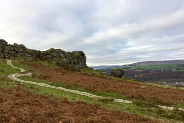
Hide Ad2. Cross with care and turn right to walk along the pavement for a short distance. Opposite Moor Road turn left to go through a gate and follow an obvious path uphill. Just below a house go right on a good path which runs along the edge of Burley Moor. Eventually it descends towards the top of the Cow & Calf, seen ahead. Ignore a path forking right and continue ahead to turn right on an intersecting path which leads down to the Cow & Calf car park.
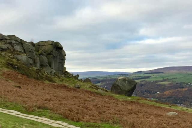
3. Cross the road with care to take a path running downhill for a short distance, and fork right to a gate giving access to the golf course. Follow this fairly straight path along the edge of the course, heeding a warning sign about the danger of flying golf balls. Leaving the golf course, pass a house and continue ahead through the parking area of a housing development.
4. Beyond the car park turn right to follow a road uphill towards High Stead. At Mount Stead go left uphill. Before the next farm go through a field gate on the left to follow a bridleway. Bear left in the field to a wall corner and turn right to pass through a wall gap. Follow this path to turn left on a farm road; follow it road past the buildings and at a right hand bend keep ahead through a gate. Follow the obvious path to an unmade road, and beyond a housing development fork left to follow a path leading to a tarmac lane back to Station Road.
Difficulty rating: 2 stars.
Distance: 6 miles
Time: 2 hours
Map: OS Explorer (1:25000) 297 Lower Wharfedale & Upper Washburn Valley.
Advertisement
Hide AdAdvertisement
Hide AdParking: Informal/responsible, Burley-in-Wharfedale, or at Cow & Calf Rocks.
Public transport: Burley-in-Wharfedale is on the Wharfedale railway line from Leeds and Bradford, and served by buses from Leeds, Harrogate, Skipton and Keighley. For services check www.wymetro.com or 0113 245 7676.
Toilets & refreshments: Burley-in-Wharfedale, Cow & Calf.