Weekend Walk: Slaithwaite Circular


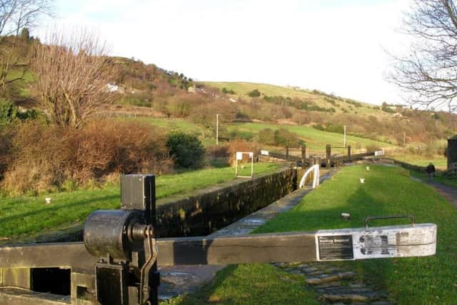
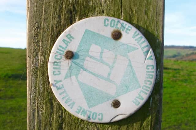
Slaithwaite (locally pronounced Slawit, old Norse for timber-fell clearing) is a village with many old mills that once spun woollens, cotton and silk. The bulk of the route is infallible, following the towpath of the Huddersfield Narrow Canal and part of the Colne Valley Circular Walk (CVCW). The latter runs parallel to the valley to provide superb elevated views, and the highlight is a track called Hollins Lane. Running through the valley, and crossed twice, is the busy A62 which was one of the main trans-Pennine roads before the M62 Milnrow-Outlane section opened in 1970. Note for walkers arriving by train: the westbound and eastbound platforms and on opposite sides of Crimble Bank. Birds seen along the route include common buzzard, kestrel and barn owl.
1. Start from the mini-roundabout at the junction of Carr Lane and Station Road. On the south side of the canal follow the towpath eastwards (Huddersfield direction). At Bridge 41 turn right on a lane, swinging left in front of metal gates to cross a bridge and follow the road up to the A62.
Advertisement
Hide AdAdvertisement
Hide Ad2. Cross the busy road with care. At a signpost beside a row of houses to the right follow the footpath uphill, forking left to arrive on an unmade road at the hamlet of Upper Clough. Look for a footpath sign on a lamppost and follow it right. Continue ahead across fields. Ignore a tempting metal kissing gate on the right but fork left to continue at a higher level. Past Heywoods Farm join the access road and walk out to a tarmac lane.
3. Turn right downhill a short distance then left on a bend to continue following CVCW waymark arrows. The route descends into Kitchen Clough and bears right to a footbridge over Bradley Brook. On the other side go up a steep field. Turn left on the B6109 at the top and cross with care to continue on the waymarked path to New House. Swing right there to follow a lane and at a junction, go to the right of a house ahead to follow the CVCW path to Hill Top.
4. Turn right on the lane and walk down hill a short distance to go left on a track, Hollins Lane, in front of houses. Keep following the waymark arrows, passing a ruined farm, and below a farm above (named The Hill on OS maps) look for a walled path which goes sharp right downhill. Follow it to the left of a row of houses to arrive back on the A62.
5. Cross the road with care, turn left to the Olive Branch Inn and go right to pass through the car park then left round the bottom of the beer garden to find a field path leading into woods. Cross the River Colne by footbridge and take the clear path up to the Huddersfield Narrow Canal. Turn right and follow the towpath back to the starting point in Slaithwaite.
Distance: 5 1/2 miles
Time: 2 1/2 hours
Maps: OS Explorer (1:25000) OL21 South Pennines
Parking: Slaithwaite
Advertisement
Hide AdAdvertisement
Hide AdPublic transport: The number 184 Huddersfield to Oldham bus service stops in Slaithwaite, which is also served by trains from Huddersfield and Marsden. Phone West Yorks Metro on 0113 2457676 or visit www.wymetro.com
Refreshments: Slaithwaite; Olive Branch Inn on A62
Toilets: Slaithwaite & for refreshments customers