
Drighlington, West Yorkshire: The village in a league of its own
The M62 corridor is known as rugby league’s heartland, and just east of its mid-point there’s a village overlooking the motorway that boasts an incredible 21 teams and 470 players playing the northern code.

At the southern entrance to Drighlington, the Drig Dragons’ well maintained pitches off Station Road and Adwalton Moor underline the community’s passion for the sport, which saw them named Community Club of the Year at the 2026 Leeds Sports Awards earlier this month.
Administered by Leeds, Drig, as it is known by some locals, has a Bradford postcode due to its position one mile closer to the latter city.
It’s 383 years this month since much of the land separating Bradford and Drighlington, as well as the Adwalton Moor park in the village, served as the site of a English Civil War battle. The Royalist Earl of Newcastle’s troops and those of Sir Thomas Fairfax, the Parliamentarian general who led the New Model Army engaged on what remains open moorland off Moorside Road.
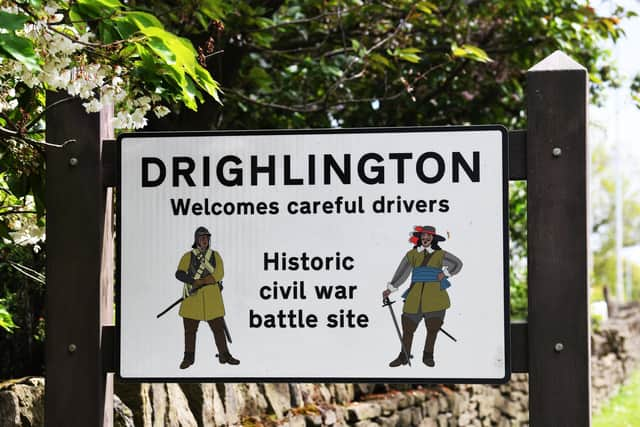

It’s thought several of the hedgerows and bell pit coal mines, which have become ponds in The Plantation area, formed part of the scene for which 14,000 men lined up, including more than 5,000 on horseback.
Fighting took place across one and a half miles, between Tong roundabout at Westgate Hill and the summit of Adwalton Moor, with a result which historians consider among the most important in the conflict as it saw Royalists gain control of the North.
The south-eastern area of the battlefield, which is encircled by housing, features boulders bearing bronze plaques as well as a panel, on the the Moorland Road library, giving details of different points in the battle.
About half of the battlefield site has been built over, with road names in the southern area of the village, such as Fairfax Avenue and Oakwell Road, commemorating where the Royalist gun line formed or the route of the Parliamentarian retreat.
Confusingly for delivery drivers, Moorside is the name of a Road, Drive, Crescent, Avenue, Gardens, Close, Parade, Approach, View, Mount and Walk in the village, which also has a Moorland Road.
The latter is the base for Drighlington Primary School, which overlooks the moor, has a logo featuring a circle and a crown to represent the Roundheads and Cavaliers, as well as a mitre to herald James Margetson, who was born in the village and went on to become Archbishop of Armagh, Primate of All Ireland.
Margetson founded the village’s first school on Whitehall Road, near its junction with Bradford Road and King Street, just two years before the battle. Its successor, Drighlington Free Grammar School, which the cleric also founded, served the village for nearly 200 years before it was replaced by Drighlington Board School, which itself was replaced by housing on Whitehall Road.
Built at a cost of £1,200 in the 1870s, the decorative building features carved lettering reading for entrances to the girls and boys departments of the school, square Doric-style columns and pilasters, and a tower with a pyramidal lead roof and weathervane.
Next door is the former King’s Cantonese restaurant premises, a grade II listed building thought to date from the opening of the Bradford and Wakefield Turnpike Road it was built beside in the 1750s, while the stables and coach house to its rear follows the alignment of the Leeds and Whitehall Turnpike Road in 1825.
On another side of the crossroads stands Prashad, a Gujarati restaurant, which specialises in vegetarian dishes. It offers a seven-course tasting menu and boasts of being the sole two star AA and Michelin Bib Gourmand Indian Restaurant in Yorkshire.
Opposite Prashad stands Drighlington’s top landmark, an outsized advertising sign for Larkspur Soft Drinks, on the wall of the previous base of ginger beer and lemonade manufacturer Scott’s Pop, on King Street.
As such, the parish council has funded repainting the artwork commemorating how one litre glass bottles of the fizzy drinks were delivered by milkmen as park of a failed bid by local dairies to compete with the supermarkets from the late 1970s.
Just yards away, at the junction of Station Road, Drighlington Medical Centre, stands at the core of the village.
Last month, some 87 per cent of responses from its patients stated their needs were definitely met during their previous general practice appointment, making it the top rated surgery across Leeds.
Nearby, opposite the imposing Malt Shovel Inn, the village’s modest war memorial, features a wooden cross in a recess off Whitehall Road.
Drighlington’s historic properties of note are almost all in the Whitehall Road area. On the opposite side of the road to the former school is St Paul’s Church, which was completed a year after the board school. Its nave is graced by pointed-arch arcades while an opus sectile mosaic - where pieces of stone, mother-of-pearl, or glass are cut precisely like a jigsaw puzzle - above the chancel depicts St Paul among coconut trees.
Alongside weekly Sunday services, the church hosts the Little Angels playgroup as well as a monthly bereavement cafe.
Nearby are a group of listed properties linked to Lumb Hall, which Historic England describes as “a fine example of a yeoman clothier's house in the Halifax tradition and unique in this region”.
It was built three years before the battle and the two-storey porch with wheel windows have seen it likened to Barkisland Hall, in Ripponden and East Riddlesden Hall, Keighley. The building thought to be the village’s oldest stands on the opposite side of Back Lane – a late 16th century timber framed barn with slate roof, which was encased in stone in the early 18th century.