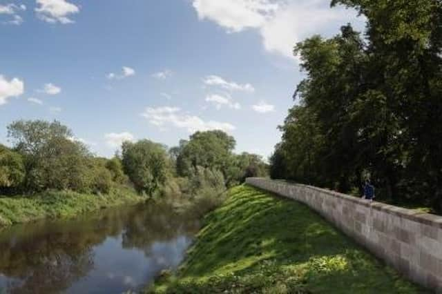
Surveys under way for £14m flood defence scheme


Contractors working for the Environment Agency are carrying out surveys to let planners create a detailed design for the Tadcaster Flood Alleviation Scheme.
Work currently under way includes 3D laser scans of the bridge elevation and arches, ground-penetrating radar, CCTV monitoring of pipes and drainage and topographic surveys.
Advertisement
Hide AdAdvertisement
Hide AdThey will be used to create a comprehensive picture to create plans for the new defences.
Public consultation on the scheme closed in July.
The technical phase will take into consideration feedback from residents and business owners in Tadcaster.
With a huge catchment area – roughly 1,000 square kilometres – the River Wharfe collects huge volumes of water before it reaches Tadcaster.
The last flooding in a town with a long history of floods was in February 2022.
Advertisement
Hide AdAdvertisement
Hide AdContractors making marks on footpaths can be expected to be seen around the town as they conduct surveys from the viaduct, past Crane Cottages, along to the Ings and on both sides of the river.
Excavation and drilling work has also begun to assess ground conditions, predominantly near the Wise Owl building.
It is hoped the results of the survey will allow a planning application to be submitted to North Yorkshire Council in the winter, while a number of drop-in sessions will be held to allow residents and businesses to raise concerns or queries.
Proposals so far include sheet pile flood defences clad in masonry so they remain in keeping with existing buildings and walls in the town.
The scheme is expected to cost around £14m, with £9m provided by the Government.
