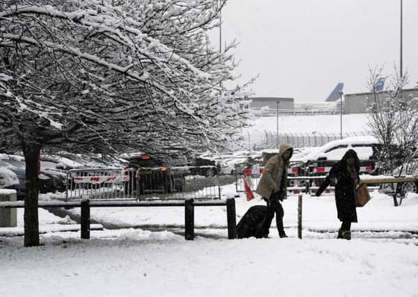
Why the cold snap is forecast to last for at least another week with snow and sleet on the way


The Met Office said the UK has not seen the last of the snow after weekend temperatures reached minus 7C (19.4F) in some parts of northern Scotland and Yorkshire saw some more snow on high ground.
Temperatures on Sunday night fell even further, with parts of the Scottish Highlands nudging as low as minus 10C (14F).
Advertisement
Hide AdAdvertisement
Hide AdThe rest of the UK, meanwhile, woke up to another cold and frosty morning with temperatures ranging between minus 2C (28.4F) and minus 4C (24.8F).
Yellow weather warnings are to be issued for ice and snow around the eastern and western coastlines, though the bulk of inland UK will remain clear.
The wintry showers will continue across north-west England and northern Scotland into next week.
Despite still feeling cold, Monday will see a good deal of sunshine and fewer showers, though these may fall as rain, sleet or snow.
Advertisement
Hide AdAdvertisement
Hide AdNorthern Scotland is expected to be blasted with further snow showers, while parts of England and Wales can expect a scattered mix of wintry showers.
Met Office forecaster Charlie Powell said of Monday: “Hopefully we will see an even sunnier day still with one or two showers around but on balance probably fewer showers than we have seen today. Tomorrow will be a slightly better day but still feeling cold and wintry.”
By Tuesday a fragmented band of rain will have worked its way in, hitting the cold air and causing rain, sleet and snow.
Mr Powell added: “The middle of the week is when we start to see things change. Tuesday morning we see a band of rain working its way in from the West and that meets the cold air sitting across the UK.
Advertisement
Hide AdAdvertisement
Hide Ad“Especially from northern England northwards, we will see it turning to snow. Most of it will fall over the hills, the Pennines, North Wales, but it could get down to lower levels across parts of Scotland. There’s likely to be another warning in force for ice or tricky driving conditions across those parts of the UK.”
Tuesday into Wednesday will bring more rain across the southern part of the UK, with a period of turbulent weather consisting of strong winds.
The end of the week is expected to be drier and milder with highs of 13C (55.4F) or 14C (57.2F) in London and the South East.
Mr Powell added that by next weekend things should seem more spring-like.
Advertisement
Hide AdAdvertisement
Hide Ad“By this time next week we should be looking at things a bit more seasonal for mid-March,” he said.
This week’s forecast:
Today:
Early frost, then dry and sunny in the west. Occasional cloud likely further east with scattered sleet and snow showers likely, but snow struggling to settle during the day. Moderate northerly winds easing later. Maximum Temperature 6 °C.
Tonight:
Dry and mostly clear with showers easing in the east, and widespread frost developing. Becoming cloudier later with a little sleet and snow arriving by dawn, possibly causing icy stretches. Minimum Temperature -2 °C.
Tuesday:
Cloudy with some spells of light sleet and snow during the morning, turning to rain. Becoming drier during the afternoon but remaining rather cloudy with the odd shower. Maximum Temperature 6 °C.
Outlook for Wednesday to Friday:
Cold, wet and possibly windy on Wednesday with some hill snow possible. Thursday and Friday, variable amounts of cloud, dry periods and some rain at times, and gradually becoming milder.