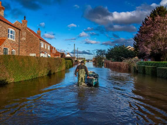
Environment Agency hits target of protecting 300,000 homes from flooding across England


The higher defences built along the estuary foreshore in the wake of the devastating tidal surge of 2013 offer better protection to 113,000 homes.
The Agency said since 2015, it had delivered £2.6bn investment in 700 projects, cutting the risk of flooding to nearly 600,000 acres of agricultural land and thousands of businesses, and saving the economy more than £28 billion in avoided damages.
Advertisement
Hide AdAdvertisement
Hide AdA record £5.2bn will be spent on 2,000 new flood and coastal defences between 2021 and 2027.
Project manager of the Hull Frontages Flood Defence Improvements Scheme Helen Tattersdale said: “We’re thrilled that we have reached this milestone. Climate change is one of the biggest global threats we face, and intense storms are becoming more frequent.
“Sea level rise on the Humber in the next 100 years is likely to be in excess of one metre. The work we have now completed will better protect properties in Hull from the increasing threat of flooding.”
The defences stretch along more than four miles of shoreline from St Andrew’s Quay Retail Park in the west to Victoria Dock Village in the east. As well as cutting the risk of flooding to homes, the work also better protects major businesses including Smith and Nephew.
Advertisement
Hide AdAdvertisement
Hide AdAbout 1,100 properties around the Humber, including 264 homes in Hull, were flooded and 7,000 hectares of agricultural land submerged in December 2013 when the city’s defences overtopped.
The record-breaking tidal surge followed two other major surges in the last seven decades, in 1953 and 1969.
Emma Howard Boyd, of the Environment Agency, said: “The success of this programme is measured in numbers - 700 projects, 300,000 homes, nearly 600,000 acres of agricultural land, thousands of businesses and major pieces of infrastructure, on time and within budget.
"But the sense of security these protections bring to people, and the benefits to nature, can’t easily be demonstrated on a spreadsheet.
Advertisement
Hide AdAdvertisement
Hide Ad“With the COP26 climate talks coming to Glasgow this year, this programme is a fantastic example of adaptation in action, but there’s a lot more to do.”
It comes as plans were submitted to Hull and East Riding Councils for an “aquagreen” near Hull’s Bransholme estate as part of the second phase of the £28.5m Holderness Drain Flood Alleviation Scheme.
It involves digging over one kilometre of new meandering watercourse and planting a mosaic of habitats, including wet woodland, which will slow the flow of surface water during heavy rainfall.
The area almost flooded in November 2019 when other parts of Hull - which has the second-highest number of properties at risk of flooding outside London - were hit.
Comment Guidelines
National World encourages reader discussion on our stories. User feedback, insights and back-and-forth exchanges add a rich layer of context to reporting. Please review our Community Guidelines before commenting.