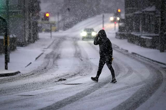
Snow in Yorkshire: Yellow weather warning issued for snow across the region this week including Leeds, York, Sheffield and Bradford

The Met Office has published its weather prediction for this week across the region, with various areas hit by snow.
The forecast for today (February 5, 2024) is a cloudy cast in the east, further west, drizzle and light rain will continue to affect the Pennines throughout the day and strong winds continuing which will strengthen over the high ground in the west. Rain and drizzle will affect the western hills at the beginning of the evening and will become heavier and widespread as the night continues with strong winds persisting across the region.
Advertisement
Hide AdAdvertisement
Hide AdTuesday, February 6 will start off with heavy rainfall and rain will slowly sink south through the afternoon when brighter spells will appear. Wind will ease throughout the day, although it is still expected to be rather breezy.

Across Yorkshire on Wednesday, February 7, there will be lighter winds and sunshine, however, rain is expected to spread north on Thursday, February 8, with a risk of snow, sinking south again by Friday, February 9 followed by brighter spells and snow showers.
A yellow weather warning for snow has been issued in areas of Yorkshire on Thursday and Friday this week including Leeds, York, Sheffield, Bradford, Doncaster and Northallerton.
A period of snowfall could bring some disruption this week.
Residents of areas affected can expect: a small chance that power cuts will occur and other services, such as mobile phone coverage; a slight chance that some rural areas could become cut off; a small chance of travel delays on roads with some stranded vehicles and passengers, along with delayed or cancelled rail and air travel.
Advertisement
Hide AdAdvertisement
Hide AdThe Met Office said: “A band of rain, sleet, and increasingly snow, will push north on Thursday bringing up to 2cm snow at lower-levels, 2-5cm on ground above 200m, and perhaps as much as 10-20cm above 400m.
“The snow will ease later in the day, and may turn back to rain or drizzle, especially in the south and east of the area.
“There is some uncertainty with respect to the rain/snow boundary, and the northern limit of the snow, and so details may change in the coming days as confidence increases in these aspects.”
Comment Guidelines
National World encourages reader discussion on our stories. User feedback, insights and back-and-forth exchanges add a rich layer of context to reporting. Please review our Community Guidelines before commenting.