Weekend Walk: Skipton Castle Woods


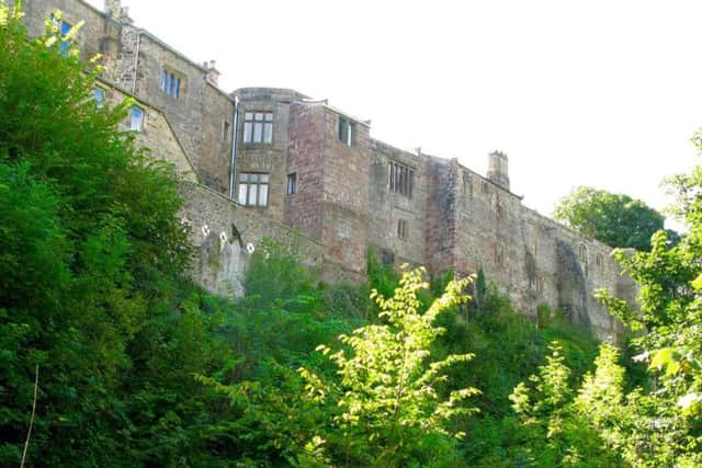
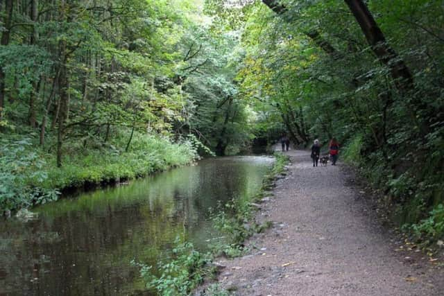
Also known locally as Springs Wood, the woodland at Skipton Castle has been an important part of the town for centuries, providing fuel and building timber, while the series of dams and canalised streams powered corn and saw mills. The woods are managed by the Woodland Trust and consist mainly of ash trees. The return part of the route crosses the shoulder of Park Hill. It was from here during the Civil War that Roundheads laid siege to Skipton Castle, which dates from 1090. They were unsuccessful, however, and the castle was the last place in England to surrender. There are great spotted woodpeckers in the woods, kingfishers and herons on the dams.
1. From Skipton town centre walk towards Holy Trinity Church at the top of the High Street. Bear left at the roundabout and cross the road with care. Walk past the church entrance and a pub to cross a bridge and immediately turn right down a flight of steps. Follow the obvious course ahead on a path which soon has Springs Canal, a narrow spur of Leeds-Liverpool, on one side and Eller Beck on the other. Above the walkway looms Skipton Castle. Eventually the path turns left over a metal bridge to a gate.
Advertisement
Hide AdAdvertisement
Hide Ad2. Turn right through the gate and walk towards a larger gate, the entrance to Skipton Castle Woods. Immediately on the other side take the main path forking left uphill, ignoring a lesser route to the right. Follow this good path to a bridge over Eller Beck.
3. Cross the bridge and ignore a path going right. Follow a path to the left of Round Dam which soon proceeds on a straight course along the side of Long Dam. The path rises to meet a bridge on the left. Cross to the other side and follow a rough path up the bank to meet a better path at right angles. Turn left and follow this path along the edge of the woods to a gate leading onto a track called Short Lee Lane.
4. Pass through the gate and within a short distance take a signposted path on the left. Cross the stile and follow the rough route visible in the meadow grass, bearing to the left of the top of Park Hill. Over on the right a clump of trees marks the site of the Civil War Battery. Cross a wall stile at the top and walk downhill, aiming for a gate to the left of the nearest house. Cross a stile, follow an unmade road down to Chapel Hill then at the bottom turn right to reach Mill Bridge. Turn left to return to the start.
Attachments area
Difficulty Rating: 1 stars
Time: 1 1/2 hours
Distance: 2 1/2 miles
Map: OS Explorer Sheet OL2 (1:25000) Yorkshire Dales Southern & Western Areas
Parking: Pay and display, Skipton Town Centre
Advertisement
Hide AdAdvertisement
Hide AdPublic transport: Skipton is on the Airedale rail line from Leeds and Bradford; also by buses from Leeds, Otley, Ilkley, Keighley and Kirkby Lonsdale. For times visit www.wymetro.com or call 0113 245 7676.
Refreshments & Toilets: Skipton