Flood in Yorkshire: What areas in Yorkshire have been issued with a flood alert and warning?

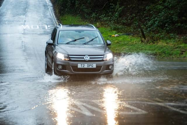
Ever-changing weather conditions are set to continue across the week, according to the Met Office, with potential impacts from wind and rain yesterday (February 22) and further rain and wind likely for some through the weekend.
Met Office warnings have been issued for wind and rain across the country, highlighting the potential for travel disruption, power cuts and a chance of some dangerous conditions near coasts.
Advertisement
Hide AdAdvertisement
Hide AdMet Office chief meteorologist, Paul Gundersen, said: “After what has been a wet February so far, further is on the way on Thursday, accompanied by some gusty winds and potential impacts for those within the warning areas which cover much of southern, central and eastern England.

“There’s a small chance that wind gusts could reach 60-70mph, mostly likely on exposed coasts, though more widely we’re likely to see a shorter spell of heavy, squally rain with hail and thunder in a few places and gusts to around 50mph.
“Most places within the warning areas are likely to see 10-15mm of rain, with a chance of 30-40mm in a few places. This is falling on saturated ground, which elevates the chances of flooding and disruption.”
Get a bespoke news round-up, as well as breaking news updates, when you sign up to the Yorkshire Post’s newsletters
Today (February 23) will be a breezy day for many, with showers feeding into many areas, though these will generally be more frequent in the west. Temperatures are returning more towards average for the time of year compared to the recent mild weather.
Advertisement
Hide AdAdvertisement
Hide AdShowers should reduce through Saturday (February 24), giving most areas a drier spell of weather. There will be further persistent rain and locally strong winds are likely to move into some southern areas on Sunday (February 25), though those further north are likely to see drier conditions.
Flood warning in Yorkshire
Low lying properties in the Upper Hull catchment
Levels in the Upper River Hull catchment remain high following recent rainfall and high groundwater levels.
Areas most at risk include the River Hull and its tributaries at Frodingham, Hempholme, Wilfholme and Burshill, including Roam Drain.
The Environment Agency is operating pumps in the area and will continue to monitor the situation. There is further rainfall forecast over the coming days.
Advertisement
Hide AdAdvertisement
Hide AdResidents are advised to put their flood plan into action and avoid using low lying footpaths and any bridges near local watercourses. Residents are urged not to attempt to walk or drive through flood water.
Flood alerts in Yorkshire
River Hull Central catchment
River levels are consistently high on Beverley and Barmston Drain and the River Hull due to recent rainfall.
Areas most at risk of flooding include local roads and low lying land around the central River Hull area such as Arram, Tickton, Beverley, and Dunswell.
More rainfall is expected to follow by a drier period into the weekend.
Advertisement
Hide AdAdvertisement
Hide AdThe Environment Agency said: “Avoid using low lying footpaths and any bridges near local watercourses, and do not attempt to walk or drive through flood water.”
Wyke Beck and Meanwood Beck catchments
River levels are forecast to rise on Wyke Beck throughout the day yesterday (February 22), after heavy rainfall last night.
River levels are also expected to rise at the Gipton South Parkway guage, with a peak at around 2pm yesterday.
The Environment Agency said: “Flooding is forecast to affect locations near the Wyke Beck, with low lying land expected to be most affected, particularly around tributaries of the River Aire in North and West Leeds.
Advertisement
Hide AdAdvertisement
Hide Ad“We will continue to monitor levels and forecasts closely. Avoid using low lying footpaths and any bridges near local watercourses and do not attempt to walk or drive through flood water.”
Upper River Calder catchment
River levels are high on the River Calder, Hebden Water and Walsden Water this morning, after rain throughout last night.
The Environment Agency said: “The majority of rainfall has now passed, and river levels are expected to fall throughout the day yesterday as no more rain is forecast.
“However, flooding remains a possibility this morning from the River Calder and its tributaries from Todmorden to Brighouse, so please continue to take care in these areas. We will continue to monitor levels and forecasts closely.
Advertisement
Hide AdAdvertisement
Hide Ad“Avoid using low lying footpaths and any bridges near local watercourses and do not attempt to walk or drive through flood water.”
Tidal River Ouse from Naburn Lock to Selby
River levels remain high on the River Ouse due to yesterday’s (February 22) rainfall. Flooding is possible along riverside footpaths from Naburn Lock and tidal foreshores, and agricultural land parallel to the River Ouse in the Cawood, Kelfield, Wistow and Selby areas.
The Environment Agency said: “Levels in York have peaked this morning. The outlook for [today] is drier. We continue to monitor levels closely.
“Avoid using low lying footpaths and any bridges near local watercourses and do not attempt to walk or drive through flood water.”
River Ouse
Advertisement
Hide AdAdvertisement
Hide AdRiver levels remain high on the River Ouse and flooding is a possibility on riverside footpaths and low lying land in York and to the south as far as Naburn Lock including Kings Staith, Queens Staith and South Esplanade.
The Environment Agency said: “Levels in York have peaked this morning. No further rainfall is expected. We continue to monitor levels closely.
“Avoid using low lying footpaths and any bridges near local watercourses and do not attempt to walk or drive through flood water.”
Comment Guidelines
National World encourages reader discussion on our stories. User feedback, insights and back-and-forth exchanges add a rich layer of context to reporting. Please review our Community Guidelines before commenting.