Snaith residents believe they have been sacrificed to save Leeds during worst floods in memory


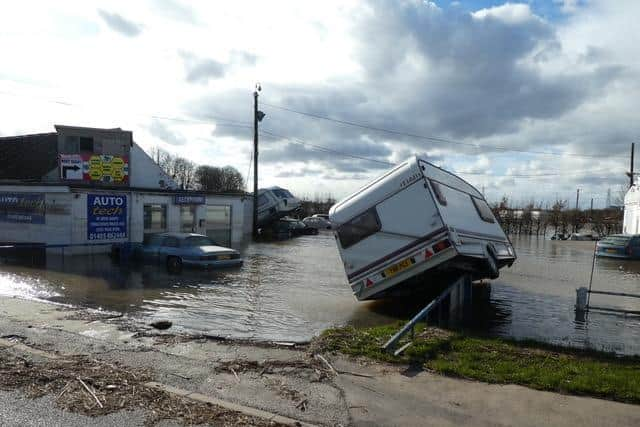
Homes and businesses have suffered extensive damage after the River Aire overtopped its banks on several occasions in February and March.
Although areas such as Ferry Lane have flooded before, 71-year-old George Clark says this winter's deluge is the worst in living memory..
Advertisement
Hide AdAdvertisement
Hide Ad"I'm from West Cowick and I've lived in Snaith since 1987. We've never known anything like this. There were floods in 2000 and in 1947, the year before I was born, but I'm told they had nowhere near the same impact.
"People have been rallying round and helping each other, filling sandbags. All the roads out of Snaith except one were blocked at one point, and Carlton Bridge is still closed, so the journey to Selby is much longer."
Mr Clark believes that the installation of extra flood defences in Leeds, including the movable weirs at Crown Point and Knostrop, has simply moved the problem further downstream.
"While the improvements in Leeds have helped there, it's moved the water to Snaith and the A19 area, places like Eggborough and Kellington which have never had anything like this before.
Advertisement
Hide AdAdvertisement
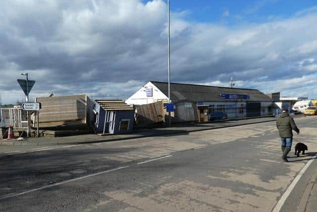
Hide Ad"A lot of businesses on Ferry Lane are still under water - there's a garage, a car showroom, an engineering firm and a beauty salon. The mud line on the engineering firm's sign is really high. They're not open yet and they can't get insurance cover because there were floods in 2000, although they weren't as severe or as widespread.
"The only thing they can feasibly do to protect Snaith now is to raise the height of the flood banks - either that or keep sacrificing the area to save Leeds."
Both the Environment Agency and Leeds City Council denied that the new defences in the city had an adverse impact on Snaith.
A spokesperson for the Environment Agency said: “All Environment Agency and local authority flood alleviation schemes are assessed for their wider impact during development.
Advertisement
Hide AdAdvertisement
Hide Ad“Schemes are designed by experienced construction teams using engineering expertise, hydrological modelling, and information from past flood events and the data from site investigations.
“Where there is any upstream or downstream impact as a result of the proposed scheme design, measures must be incorporated into the design of the flood defences to mitigate this risk. All new flood defence schemes have to meet strict planning criteria to ensure they do not increase flood risk elsewhere.”
A spokesperson for Leeds City Council added: "The Met Office has confirmed that February 2020 was the wettest February on record. This rainfall flows through the Aire catchment as it always has. The Leeds Flood Alleviation Scheme Phase 1 was designed to locally reduce flood risk in Leeds without causing an increase in flood risk elsewhere. It received the necessary permissions on that basis. The movable weirs at Knostrop and Crown Point were implemented as part of this project and the principle of the design is to provide extra room in the river channel for flood waters in the city centre of Leeds. The volume of flood water passing through the city, to merge with the both the River Calder and the River Ouse, remains unchanged."
Comment Guidelines
National World encourages reader discussion on our stories. User feedback, insights and back-and-forth exchanges add a rich layer of context to reporting. Please review our Community Guidelines before commenting.