Yorkshire flood: When is heavy rain and flooding expected to hit Leeds, Sheffield, Bradford, Wakefield, Hawes and Huddersfield? Yellow weather warning issued across parts of Yorkshire as Storm Fergus hits the UK

A band of rain, at times heavy, is moving slowly from west to east through the day on Sunday (December 10) and will affect most of the UK, ahead of the arrival of Storm Fergus to western areas later in the afternoon.
A number of Met Office warnings for rain have been issued, mainly focussed on northwest England and southwest Scotland, along with parts of northern and eastern Scotland.
Advertisement
Hide AdAdvertisement
Hide AdMet Office chief meteorologist, Andy Page, said: “Storm Fergus will conclude what has been an unsettled weekend of weather for the UK. Fergus will bring some strong winds and heavy rain for a time late on Sunday and into the early hours of Monday morning.

“While the strongest gusts are expected in the Republic of Ireland, Storm Fergus will bring some windy conditions to western areas, including Irish Sea coasts, while also bringing some potentially impactful rain. The rain has potential to be disruptive in parts of northern England and parts of Scotland, especially where it’s falling on very saturated ground.”
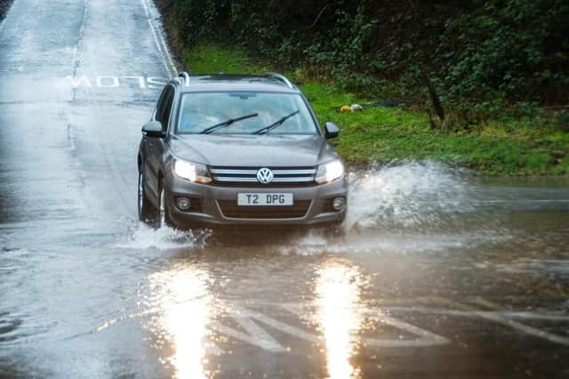
Parts of Yorkshire have been issued with a yellow weather warning for heavy rain and potential floods between 5pm today (Sunday) to 3am tomorrow morning (Monday, December 11).
Areas affected by extreme rainy weather are Leeds, Sheffield, Bradford, Wakefield, Hawes in the Yorkshire Dales and Huddersfield. Further heavy rain is set to bring in some flooding and disruption to transport.
Residents can expect:
- Possibility of flooding of a few homes and businesses
Advertisement
Hide AdAdvertisement
Hide Ad- Bus and train services probably affected with journey times taking longer
- Spray and flooding on roads may make journey times longer
Following a brief lull once morning rain clears from west to east across the area, further heavy rain or showers will develop on Sunday evening, before clearing during the early hours of Monday.
Many areas will see 15-20mm, with the wettest spots seeing 30-40mm. Given very wet ground, some impacts are likely to occur.
The Met Office has published some tips on what to do in the event of flooding.
Advertisement
Hide AdAdvertisement
Hide Ad- Give yourself the best chance of avoiding delays by checking road conditions if driving, or bus and train timetables, amending your travel plans if necessary.
- Check if your property could be at risk of flooding. If so, consider preparing a flood plan and an emergency flood kit.
- Be prepared for weather warnings to change quickly: when a weather warning is issued, the Met Office recommends staying up to date with the weather forecast in your area.
Comment Guidelines
National World encourages reader discussion on our stories. User feedback, insights and back-and-forth exchanges add a rich layer of context to reporting. Please review our Community Guidelines before commenting.