
Ousewem’s flood modelling is no crystal ball – but it can reduce the risk in York and North Yorkshire


The river looked calm that morning.No alarms. No flashing warnings. Just water sliding past the ancient stone walls of York as it has done for centuries.
And yet, somewhere behind computer screens and council desks, decisions were still being made, writes Graham Walker.
Do we act now – or wait? Do we invest here – or further upstream?
Along the River Ouse, flood risk is never abstract. It’s sandbags stacked by front doors and the quiet dread when heavy rain batters rooftops through the night.
This is where flood modelling comes in — not as prophecy, but as judgement informed by evidence.
Dr Eleanor Pearson, flood risk specialist at Skipton-based JBA Consulting, puts it plainly: “It's a means of using a computer, or using software on a computer to see and estimate where and how water moves across the land during a heavy rain.”
That rain doesn’t just fall into rivers. It runs off hills, across fields, down streets, into drains. It interacts with terrain, with soil, with buildings.
Flood modelling attempts to understand that whole system.
“It's trying to provide us with our best guess, best estimate as to what flooding may occur, how deep it may be, and who or what may be impacted,” she says.

But she is emphatic about one thing:“Nothing in this is a given or a certainty.”
That matters.Because one of the biggest myths about flood modelling is that it predicts the future. It doesn’t.
“It can tell us where things may happen, so where things may flood, what water depths may occur,” Dr Pearson says.
“But it can't tell us when a flood will happen… I couldn't tell you that Mr. Smith, at 64… is definitely going to flood on December 27, because there's inherent uncertainty.”
Instead, models deal in likelihoods.
She adds: “In each step of the process, there is uncertainty… which is why we use ranges and probabilities, because we don't know.”
That honesty is not weakness. It’s strength, in transparency and trust.
So how do you build something that can simulate a storm?
JBA Consulting are the experts, with over 1,000 staff across the UK and wider operations in Ireland, Europe and Australia, serving clients including local authorities and the Environment Agency.
It provides the modelling evidence for Ousewem, the York and North Yorkshire flood resilience programme.
JBA uses specialist software including an open-source hydraulic model developed by the US Army, a reminder that flood risk modelling has roots in military-grade engineering precision. It also has its own benchmarked in-house system, long trusted to support Environment Agency flood mapping and risk decisions.
At the core is real-world data.
“It needs data that represents the land surface… the hills, the flood plains and the flat bits. That's called terrain data,” explains Dr Pearson.
“You need some sort of water based input, rainfall or river flow; recorded data, monitored data, or estimated via models.”
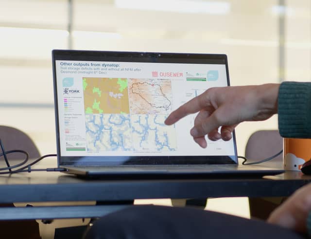
Flood models can turn that complex data into visual maps decision-makers can understand, working from detailed local areas to the entire 3,300km² catchment upstream of York.
Then there is the engine behind it all. It's physics based, mathematical equations that the models use.
But why do it at all, if certainty is impossible? Because modelling lets you test the future before you build it.
For Ousewem — exploring Natural Flood Management upstream of York — that is crucial.In the model, teams can change inputs to represent what NFM may do: adding wetlands, ponds, leaky dams, woodland, to see how that additional storage would impact the flows in the river.
It’s risk rehearsal for decisions that cost money, reshape landscapes and affect lives. And it supports proportionate action.
Dr Pearson adds: “We use models to understand where may benefit from [natural] management, It's the best estimate that we can give.”
Not everywhere needs the same intervention. Not every measure changes the peak flow. Trade-offs matter.
And so do limits — financial as much as scientific. Updating maps and monitoring costs time and money, and uncertainty creeps in when landscapes change faster than datasets.
AI could support future flood modelling, but only with caution, believes Dr Pearson.
For now flood modelling sits in a delicate space: robust science, imperfect data and finite budgets.
It cannot promise that the River Ouse will never spill its banks again. It cannot tell a homeowner exactly when water will reach their doorstep.
But it can help decision-makers weigh risk, instead of reacting blindly, and test whether upstream action might ease downstream fear.
In a city shaped by water, that matters.Because even without a crystal ball, understanding risk is better than hoping for the best.
BLOGS:
READ MORE: