
York's new river trail to highlight flood resilience

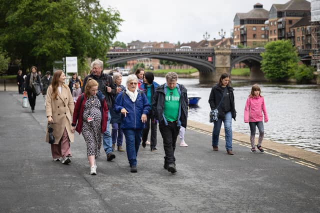

York's rivers have shaped the city for centuries - carrying trade, attracting visitors and, at times, bringing devastating floods.
But beyond the familiar images of swollen riverbanks and picturesque waterside scenes lies a bigger story about how communities, landscapes and flood resilience are connected across an entire catchment.
Now, a new project preparing to launch in York this July aims to help bring those connections into sharper focus.
The York rivers trail, developed through the Ousewem flood resilience programme and City of York Council, will invite residents and visitors to follow the course of the River Ouse while exploring the factors that influence flood risk, climate resilience and life along the waterway.
More than a traditional walking route, the trail combines storytelling, art, digital technology and public spaces to reveal how York lives with water.
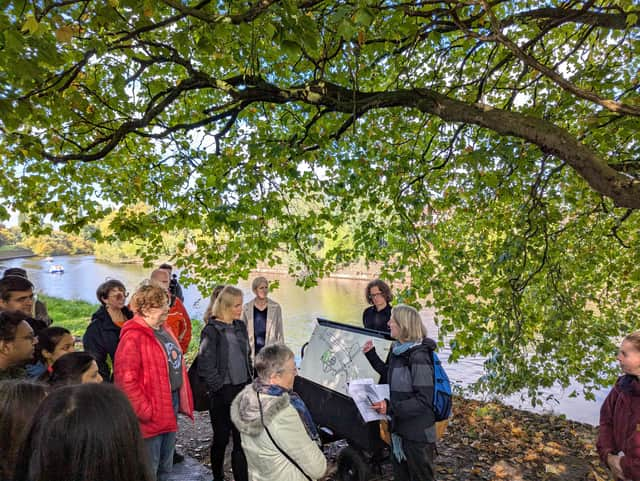
By linking riverside locations with wider conversations about nature-based solutions and flood resilience, it aims to encourage people to look beyond the river itself and better understand the landscapes and decisions that shape its future.
Emphasising the wider importance of the project, Coun Jenny Kent, Executive Member for Environment and Climate Emergency at City of York Council, said: “York’s rivers have always shaped our city. The York rivers trail illuminates this history, and explains how natural flood management such as tree planting, hedge laying and mimicking beaver style dams can help slow the flow here in York.
“The aim is to help connect people with their environment, building awareness of flood resilience, including actions we can all take, and supporting a more climate-ready city for everyone.
“It has been a pleasure to hear directly from everyone involved.”

Education is a major part of the trail's legacy.
Alongside the public experience, a curriculum-linked schools programme has been developed with teachers and education specialists to help young people understand York's rivers through local history, geography and climate resilience.
Mark Henderson, Flood Risk Manager at City of York Council, said: “York has always lived with water, and understanding flood risk means understanding the whole river system - not only what happens within the city itself.
“The York rivers trail helps make those connections clearer and more visible, showing how upstream landscapes, local action and the river through York are all part of the same story.
“By bringing together place, people and practical learning, the trail offers an accessible way for residents and visitors to engage with flood resilience in everyday settings.”
At Leeman Park and Tower Gardens, visitors will also find sculptural viewing frames designed as moments to pause and look more closely at the river and surrounding landscape. At Leeman Park, these have been installed on a temporary basis to align with the launch and will later be permanently installed as part of wider riverside pathway improvements, with accessibility requirements taken into account.
The project arrives at a significant point for Ousewem, the Defra-funded programme that has spent recent years examining how natural flood management and nature-based solutions can contribute to reducing flood risk across the Swale, Ure, Nidd and Upper Ouse catchments.
As the programme moves into a phase focused increasingly on evidence, learning and long-term legacy, the York rivers trail represents one of its most visible public-facing initiatives.
Its purpose is not simply to showcase flood resilience projects, but to help explain the often-complex relationships between upstream and downstream communities, land management, environmental change and flood risk.
That emphasis reflects a broader shift in how flood resilience is discussed. While engineering solutions remain essential, there is growing recognition that communities also need a better understanding of how river systems function and how different interventions work together across a catchment.
For Ousewem, the trail represents more than a communications exercise. It is intended as a long-term civic asset that translates technical evidence and modelling into something communities can experience directly.
As discussions continue nationally about how towns and cities adapt to climate change, projects such as the York rivers trail may provide an important test of how public engagement can support wider resilience goals.
The challenge facing flood resilience programmes is not only delivering practical interventions, but ensuring communities understand why they matter.
The York rivers trail will offer an opportunity to explore whether storytelling, place and participation can help make those connections clearer.
When it launches this summer, it promises to add a new dimension to York's conversation with its rivers – one grounded not in crisis, but in understanding.
For trail route maps, stops and more information visit https://www.york.gov.uk/york-rivers-trail.
READ MORE: